Science, freedom, beauty, adventure: what more could you ask of life? Aviation combined all the elements I loved. There was science in each curve of an airfoil, in each angle between strut and wire, in the gap of a spark plug or the color of the exhaust flame. There was freedom in the unlimited horizon, on the open fields where one landed. A pilot was surrounded by beauty of earth and sky. He brushed treetops with the birds, leapt valleys and rivers, explored the cloud canyons he had gazed at as a child. Adventure lay in each puff of wind.
— Charles Lindbergh, The Spirit of St. Louis
Prologue
I had travelled to Sedona and Grand Canyon only once during a road trip in late 2015. Since then I wanted to fly to both places and see the terrain from above, up close. I thought that would be a great adventure and I was really looking forward to be able to do such trips as a Pilot.
Palo Alto to Sedona and Grand Canyon is about 700 nautical miles away if one takes a route through Mojave. Farthest I had flown before was a recent trip from Palo Alto to San Luis Obispo, about 175 nautical miles away. I went along with Nathana, my wife, and Brian, a great friend. We were actually headed to Santa Monica for the weekend, but landed at San Luis Obispo to have dinner and get some fuel, by the time we got back to airport, sun had gone down and it was twilight. We took off and soon as the ambient light from the airport diminished and our eyes adjusted to darkness, we found out that our flight instrument panel lighting was not enough to continue flying in the night. We immediately turned around and landed. Airport facilities were closed by the time we secured the plane and we were now in unfamiliar city for the whole night. We decided to take Uber to Pismo Beach, got ourselves a lodge, and spent a beautiful time at the beach staring at fire lit shoreline with milky way in the backdrop. We were happier with the way the things had turned out. Everything I had imagined about being a pilot and what fun would it be able to fly to places with friends was indeed true. I was even more looking forward to a week long trip that involved just flying and going to these places in the wild west, that were once to me only symbols on a map.
Plan
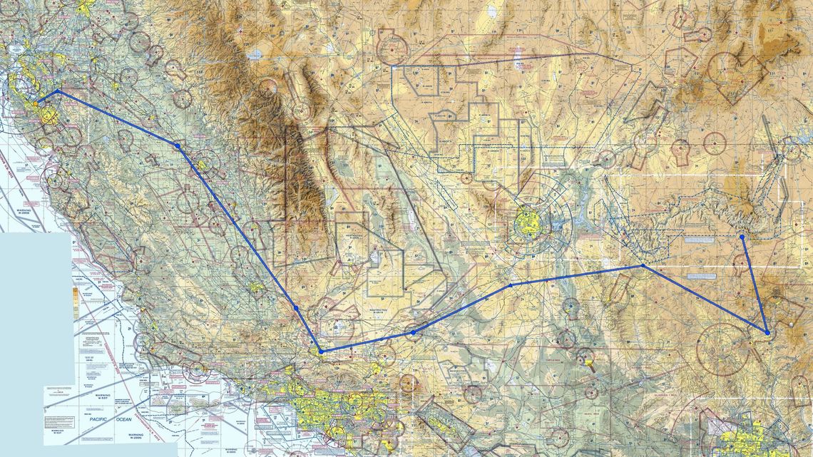
I had vague idea of the route that I wanted to take in a Cessna 172S and 2 passengers:
- Palo Alto to Mojave
Take off from Palo Alto, fly towards Tracy and then head south to Bakersfield and then fly along the highway to Mojave through Tehachapi. Technically I had done this flight during training as a pilot. I flew from Mojave to Visalia with my flight instructor and then solo from Palo Alto to Fresno, very close to Visalia. Hence I was more comfortable flying over a familiar course. Mojave also has a special place in my heart, for the past two years I used to drive from Palo Alto to Mojave for flight lessons, and it was going to be the first time I was going to fly in to Mojave spaceport as a private pilot. - Mojave to Barstow
There’s lot of military operation in Mojave area and Edwards Airforce Base airspace (R-2515) had to be avoided. I studied routing flight north of Edwards air force base, but there are multiple restricted airspaces leaving very little room for deviations. I liked the idea of having more airspace to ourselves. - Barstow to Lake Havasu
Following the highway 40 for the most part. Not many airports to land during an emergency but there’s plenty of flat land and people on highway 40. - Lake Havasu to Sedona
Relatively simple and straight flight - Sedona to Grand Canyon
Straight forward flight around Bill Williams Mountain
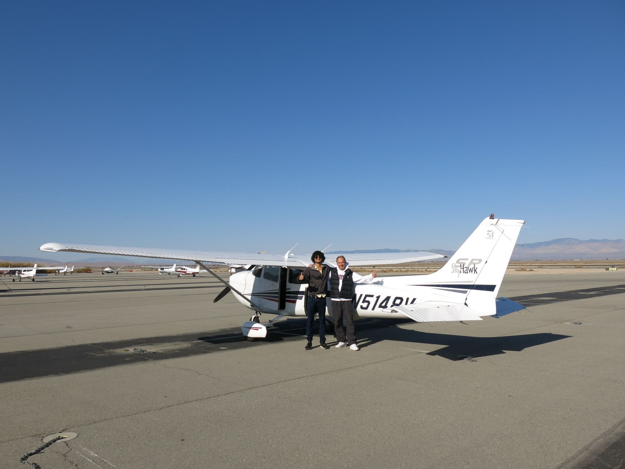
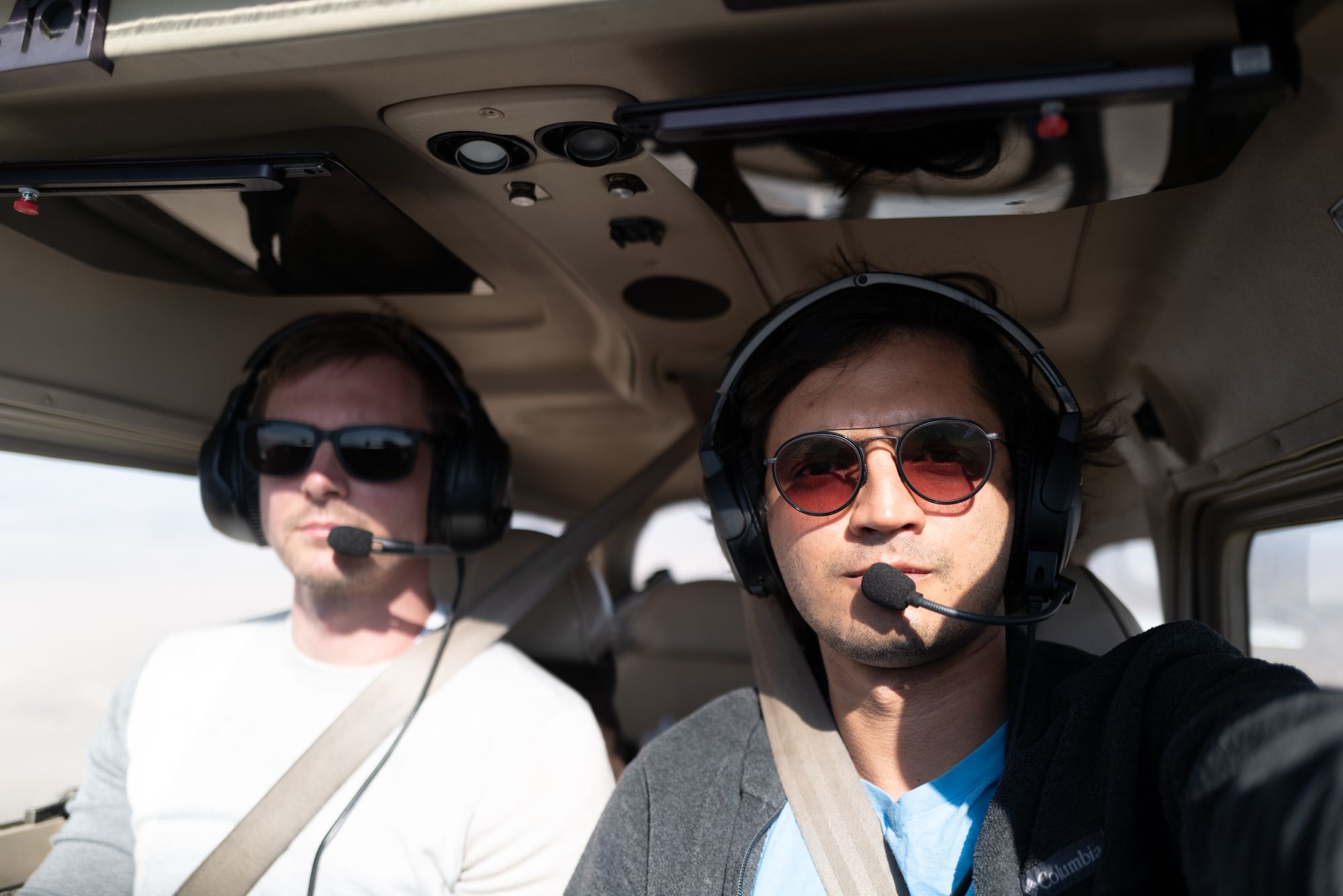
This trip was going to be with Tomi And Rahul. My friend, Tomi, had flown in from Switzerland, hoping to be able to fly to Sedona, one of the places we had wanted to go for many years. Rahul had came to the United States for the first time to study and he had only once in a small airplane before, 40 minute flight over Stanford area with me.
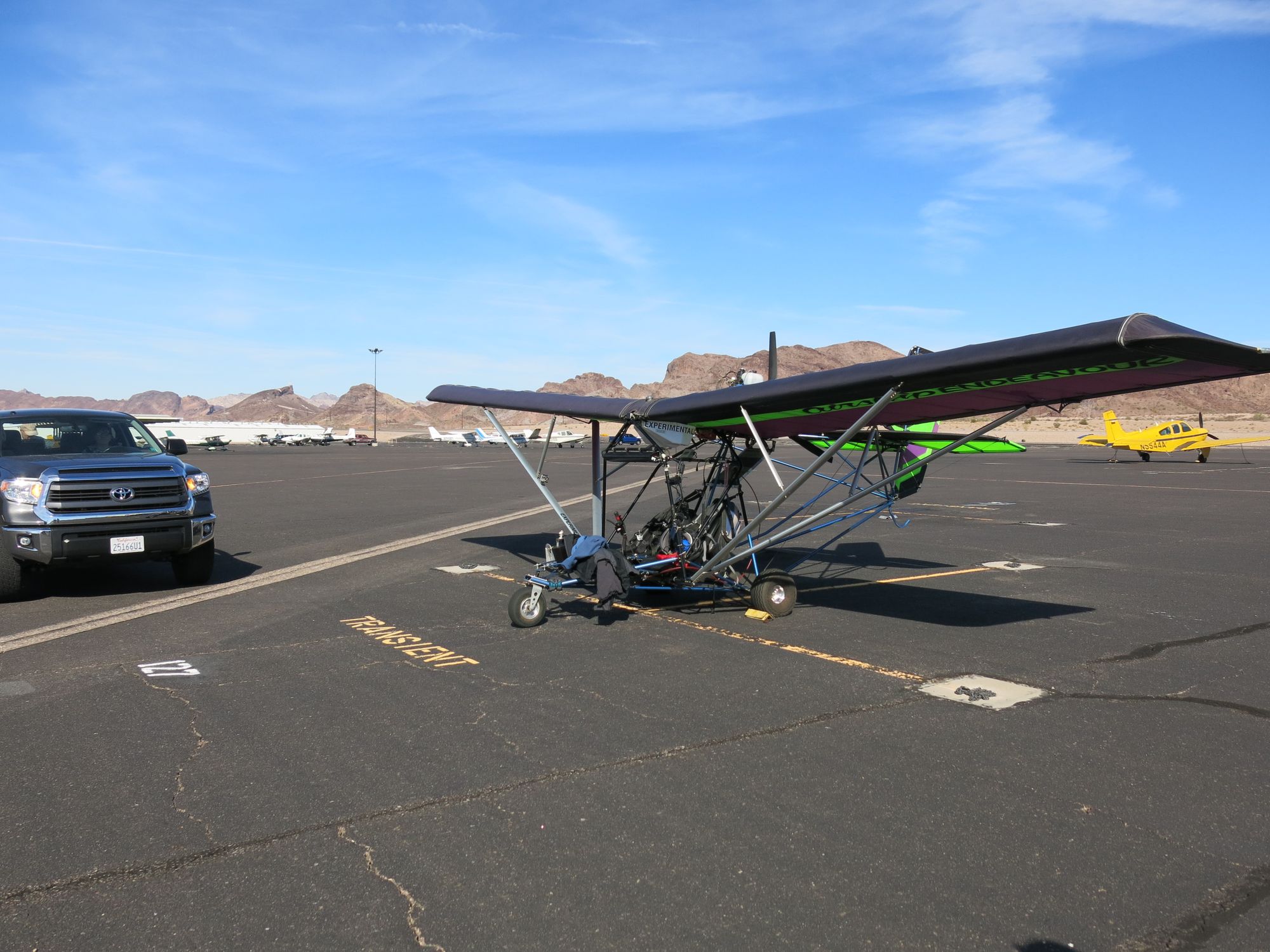
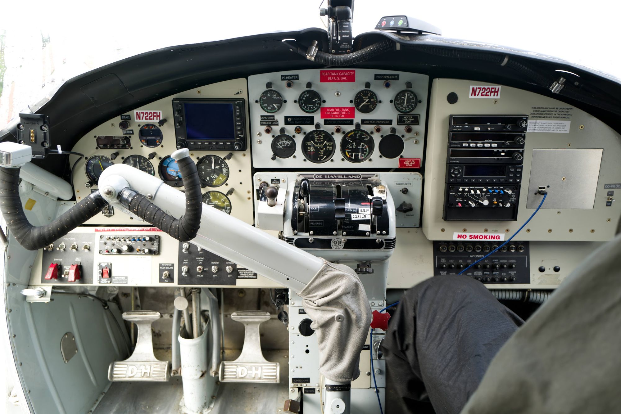
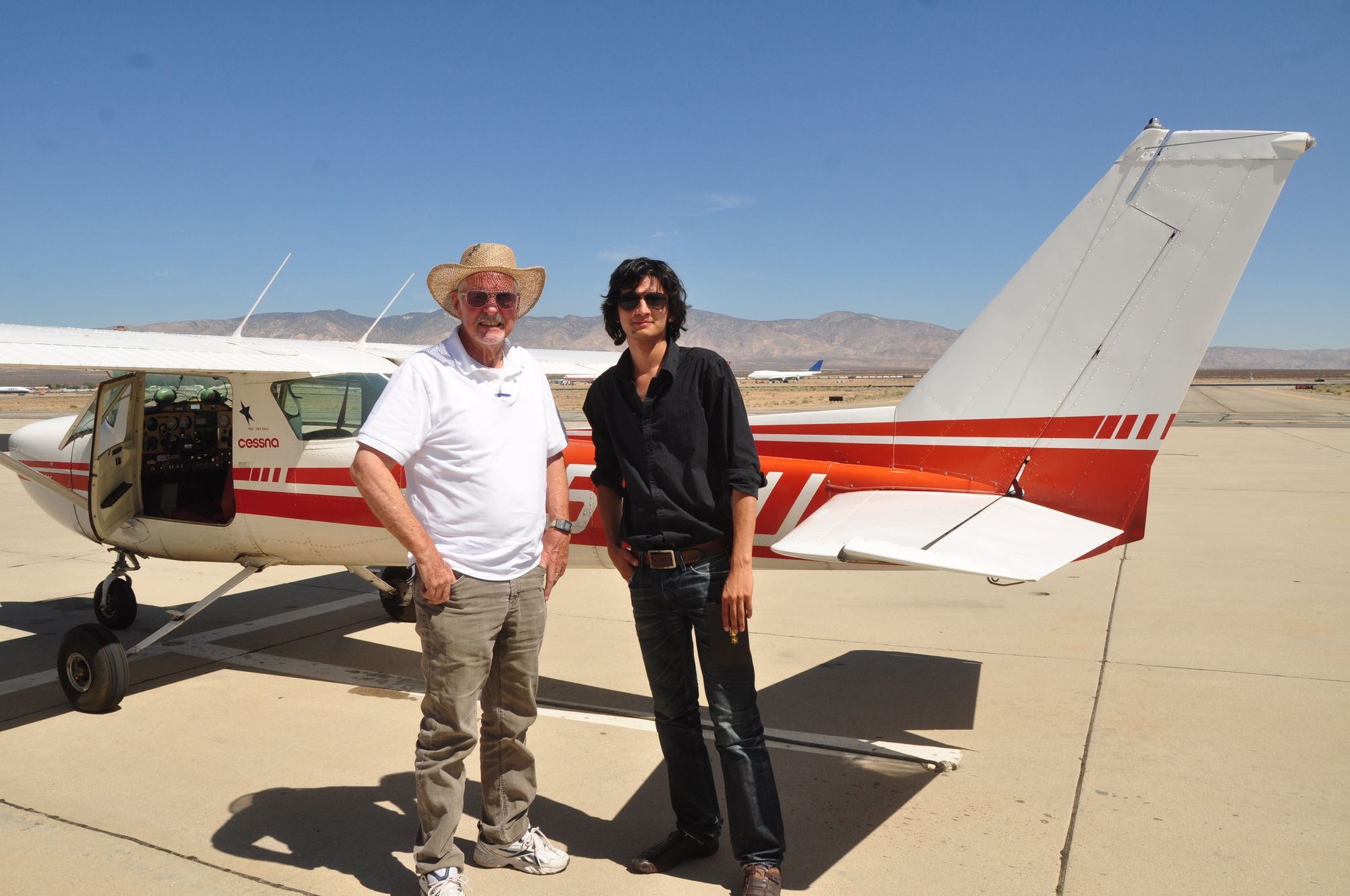
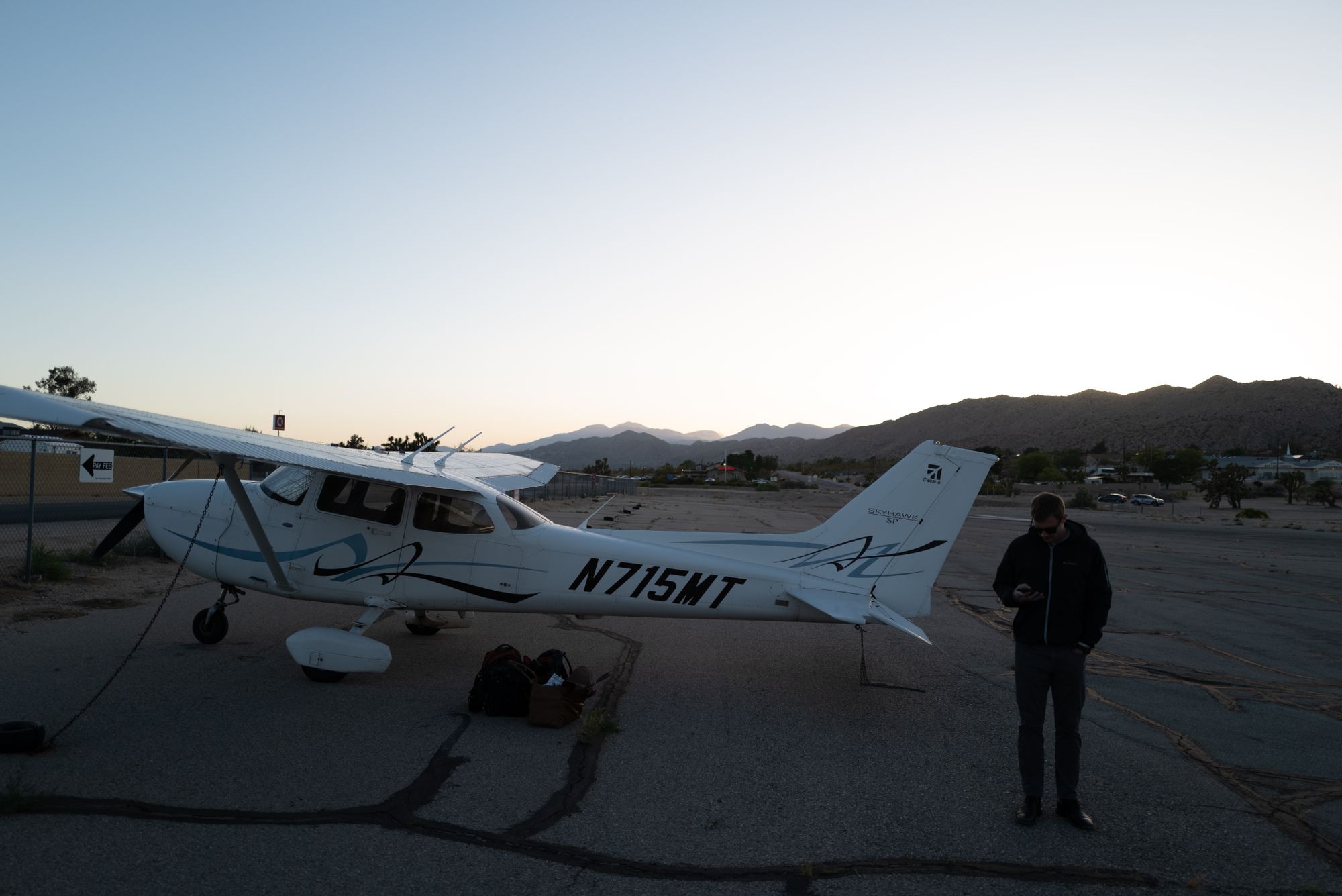
I reserved the plane for about 8 days about a month earlier than the intended date. We were going to leave Palo Alto on Saturday (November 19, 2016). The plane was 2002 Cessna 172S, N5148V equipped with GPS and autopilot. This plane is also one of the newer ones in the club. I had flown this a few times before and continued flying this for short local flights with friends. In my opinion, familiarity with the aircraft is very important, one has to train the subconscious self with all the instruments and gauges and their location spatially. This helps to reduce amount of things to process in the brain in the event of an emergency.
Weather
November is not the best month to have 7-9 days of clear skies in northern California, especially around the bay area and central valley. This wasn’t immediately clear to me before. I had researched into historic weather on similar days and weeks in the past years, and all this indicated VFR (visual flight rules) weather around thanksgiving in the past years (at least on civil weather forecasts). Despite, a cold front was predicted for the thanksgiving week, there was a slight chance of weather clearing up. All in all, this exercise gave me an idea of range of temperatures we would experience throughout the route. Most importantly there wasn’t chance of encountering freezing conditions.
It rained on November 19th and so did on 20th but 21st was predicted to clear up around noon. Weather for a week later was predicted to be cloudy with some chances of rain, with a ~40% probability. At some point during these days, we decided we would take a chance and leave as soon as we found an open window of clear weather in Palo Alto and central valley. Throughout this time, it was bright and sunny throughout the eastern side of Sierras.
21st turned out to be clear day with some patches of low level clouds, and airports in central valley predicted to have the fog burned up by 1 pm. All of us were ready and at the airport around 10 AM.
The Flight
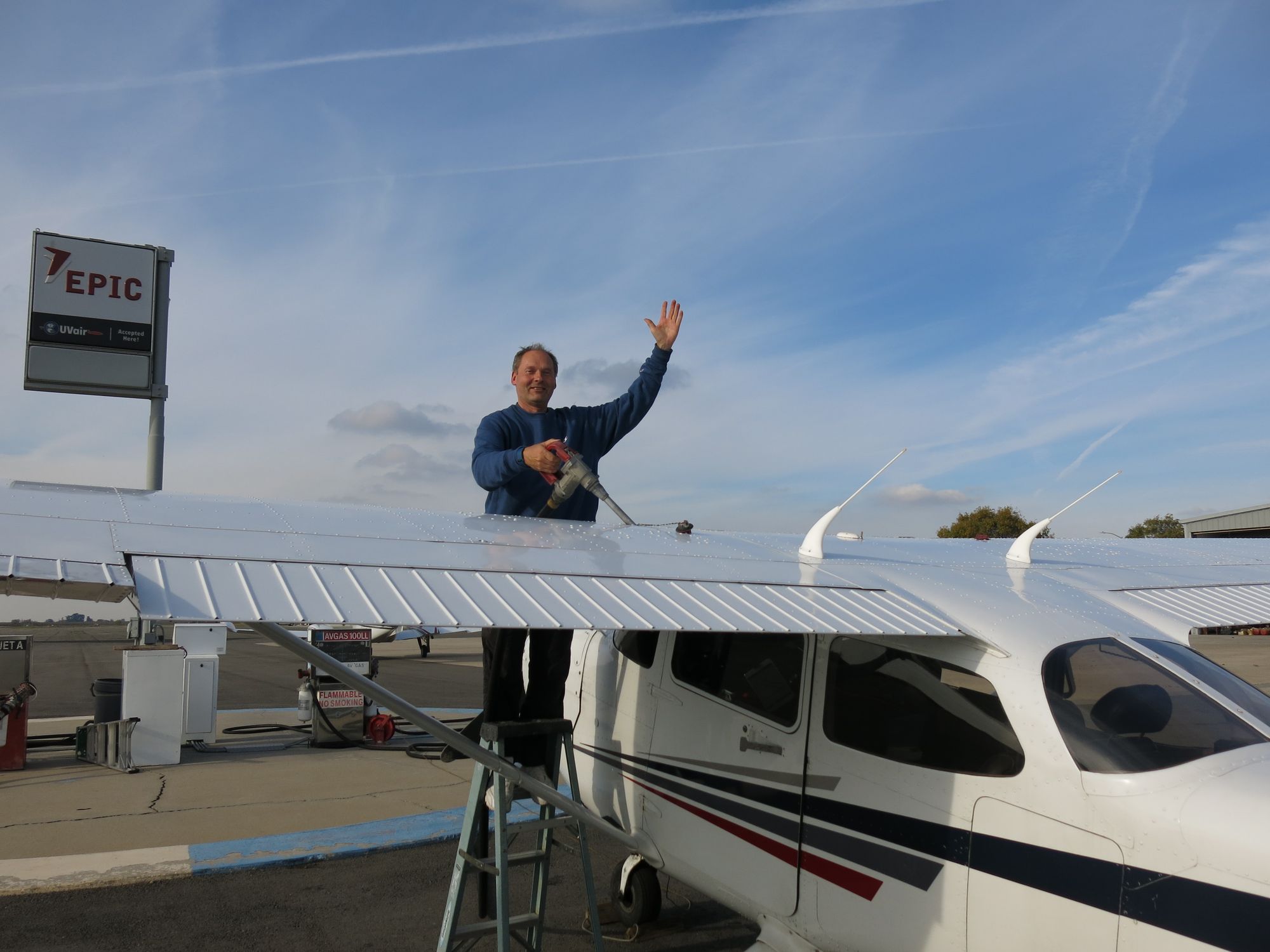
Palo Alto to Madera, 5,500 feet, refueled 19 gallons
We actually wanted to make it to Bakersfield non-stop. But Bakersfield was reported to be covered by dense fog. But the nearby airports were reporting clear weather. So I decided to still begin the flight towards Bakersfield, with optimism that it may get better later in the afternoon. We took off from Palo Alto and took right crosswind departure instead of flying through San Jose airspace, to avoid some clouds in the south and less talk with controller. Flight was simple, I just followed the highway and railroad tracks. I decided to land at Madera airport just south of Fresno to refuel tanks. Tomi and Rahul had their first experience of self refueling the aircraft. It's kind of fun, instead of car, we had a plane and we “park” it next to the fuel station. Now we had enough fuel to fly into the desert non stop.
Madera to Mojave, 9,500 feet, refueled 14.5 gallons and night stay
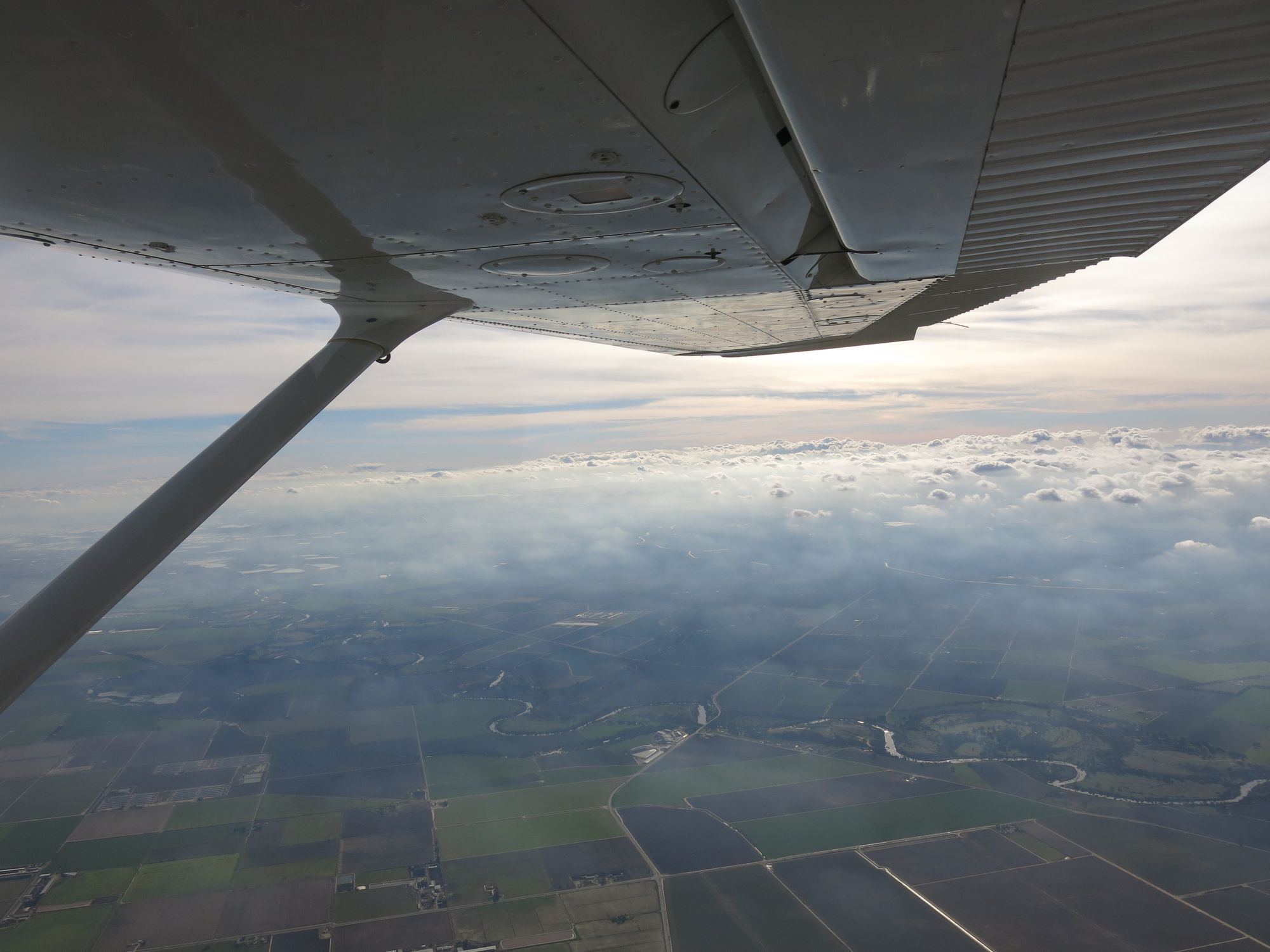
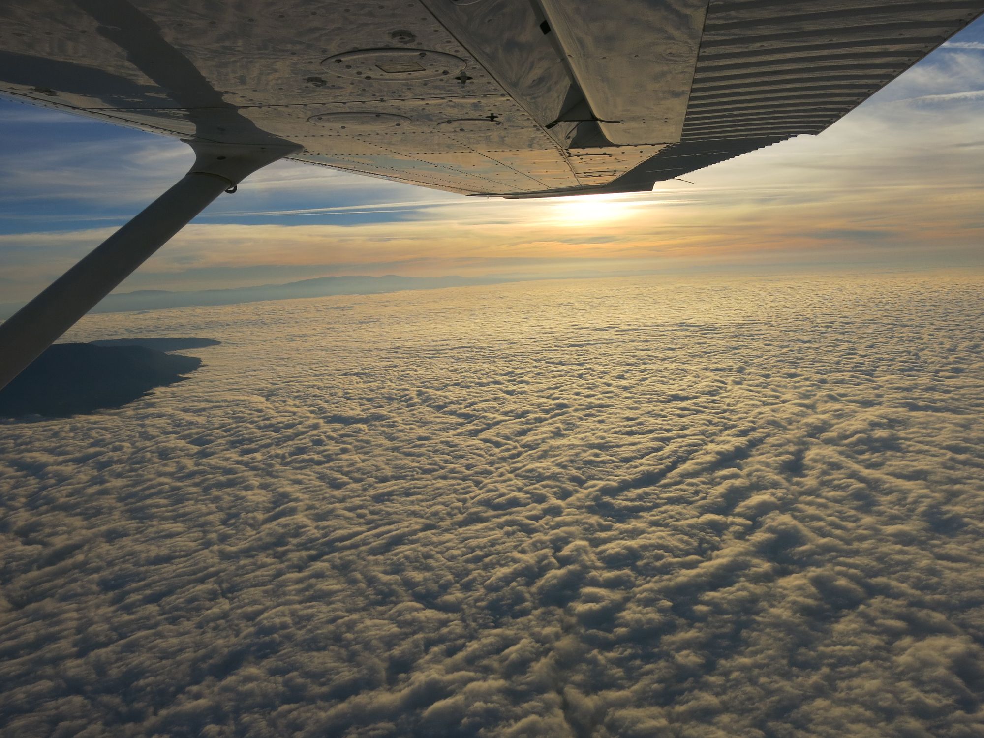
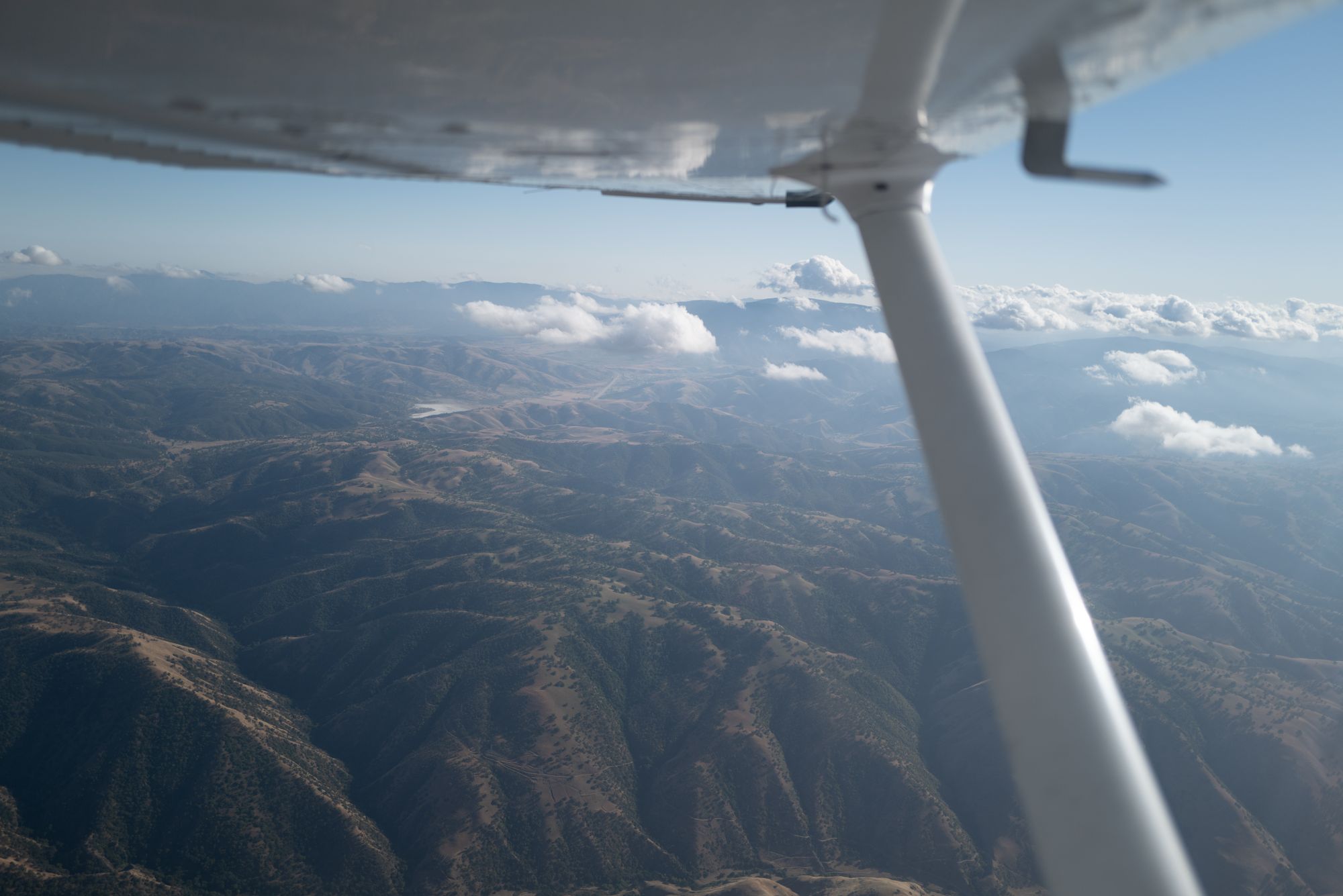
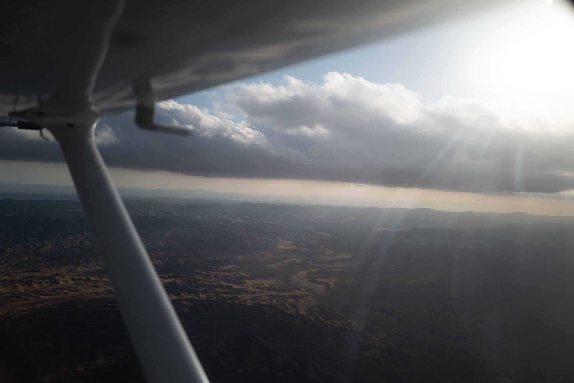
Bakersfield was still severely covered with fog but Porterville about 30 miles north was reporting clear weather. That could be my backup airport if for any reason I had to land around Bakersfield. I planned to fly at 9,500 ft to stay above the weather and soon we approached Bakersfield area and could see the San Joaquin valley covered in fog, it was beautiful view. At a vantage point like this, it is easier to sometimes comprehend weather phenomenon, the fog was trapped in the southern end of San Joaquin valley and not enough sun light to energize it to either burn or cross the mountain ridges. Crossing the mountains from Bakersfield to Mojave is one of my favourite routes both by land and air. I just followed the highway and railroad tracks that cuts the sierras into the dry Mojave desert.
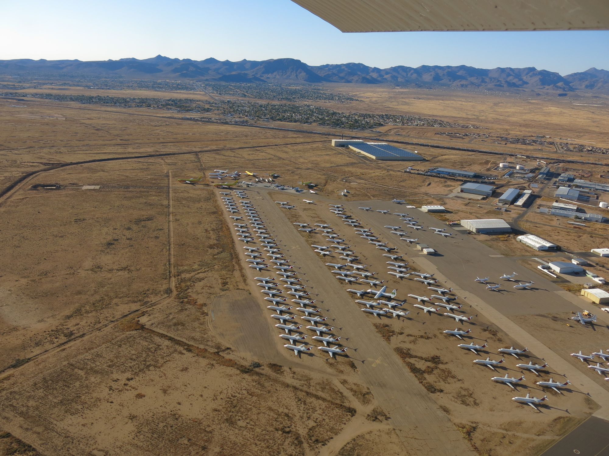
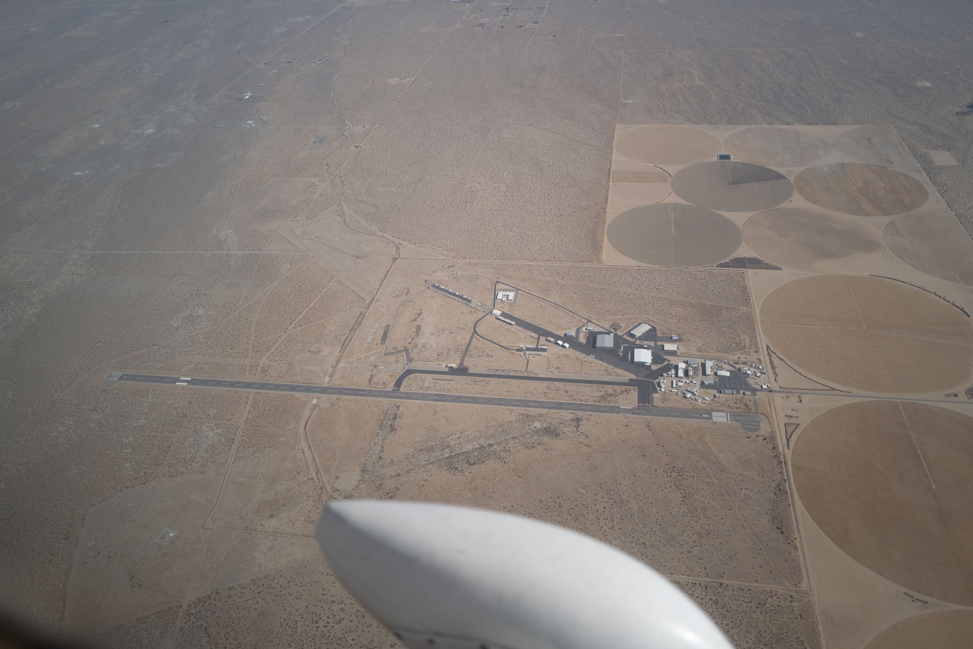
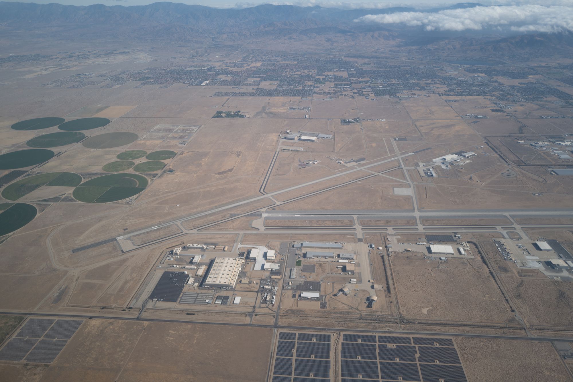
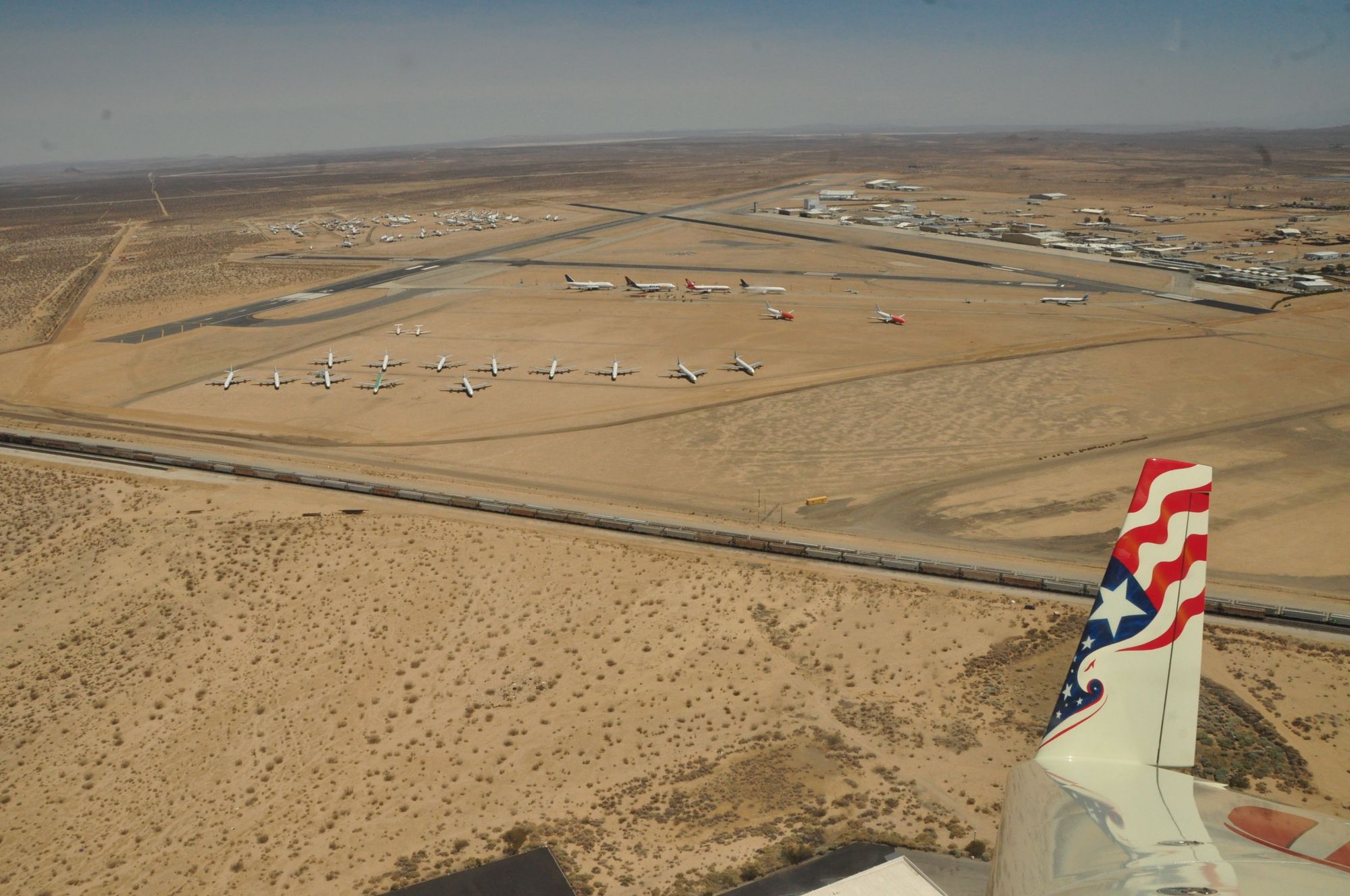
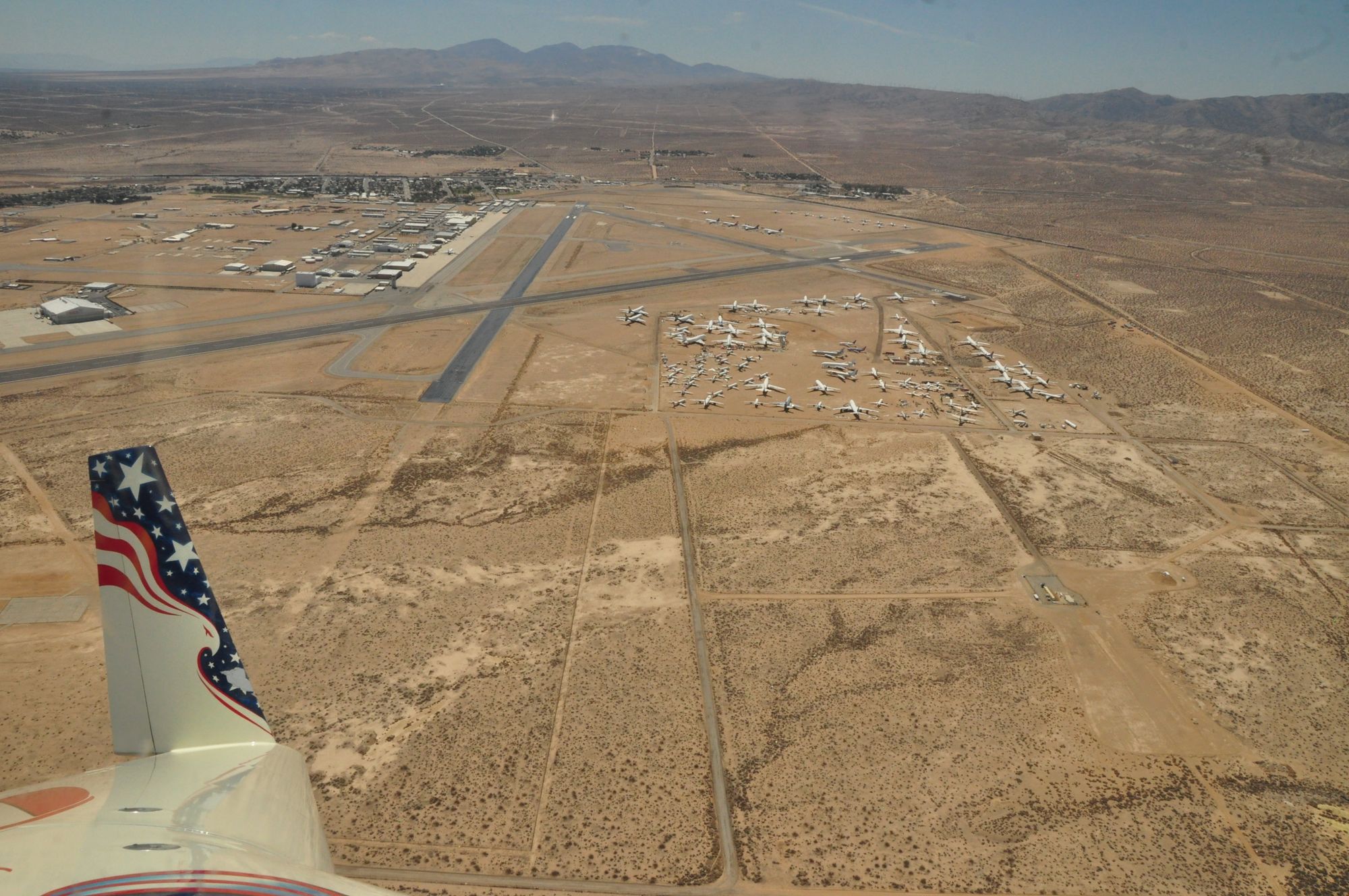
Approaching to Mojave is majestic, flying in from the west, first you are welcomed with wind turbines spread miles in all directions and then big jets parked in the aircraft graveyard next to the long runways. I was at 9,500 when I first called Mojave tower, the controller greeted happily and said “Straight in for runway 08”. I began my descent but I was too high and with mild thermals, it was harder to descent as fast as I would have liked to make it straight to runway 08. There was another aircraft inbound on the other side of runway (26). So I flew towards the right and joined left traffic for runway 26, landed and taxied to the Voyager restaurant. This is the restaurant where I first met my instructor, Dick Rutan, and continued to meet every time we flew for flight lessons. It was after all great to be back, and this time as a pilot!
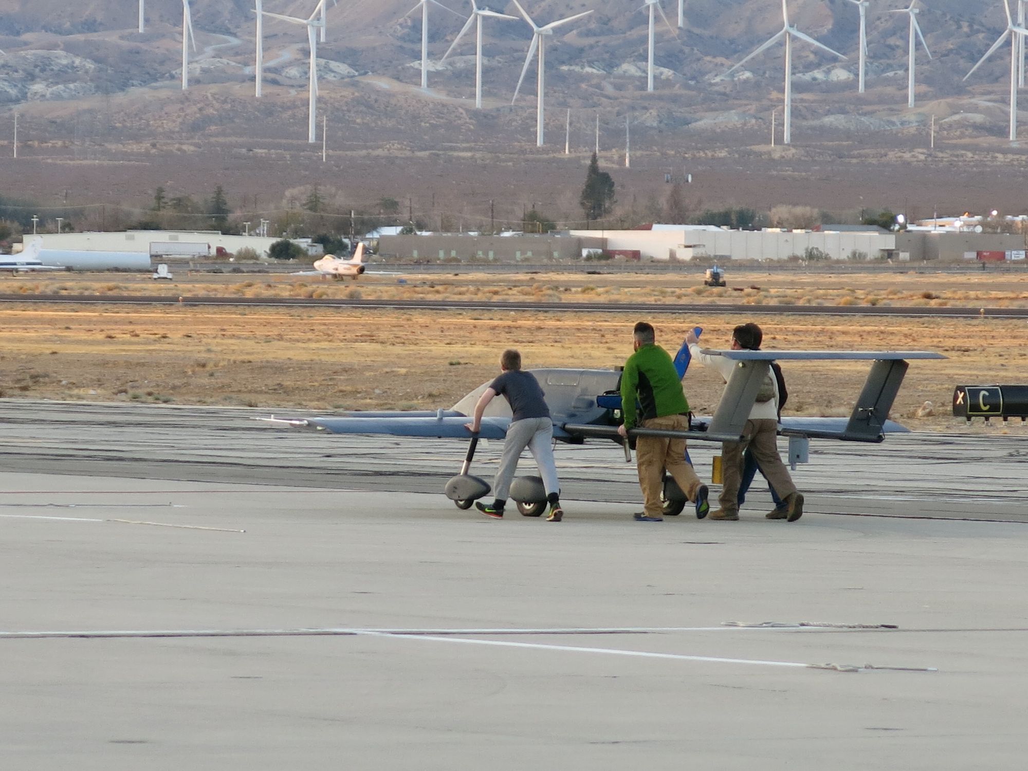
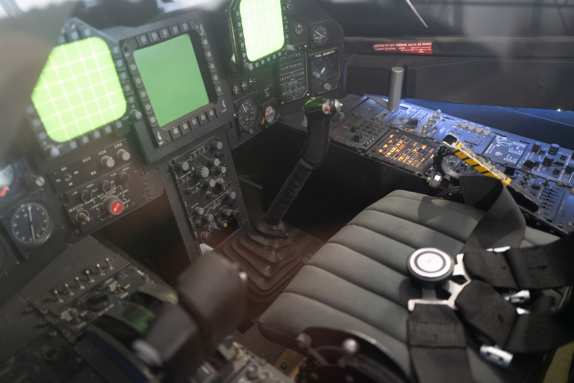
Within 30 minutes of securing the aircraft, we saw a fighter jet F-16 maneuvering about 1000 feet above the ground, practicing landings on one of the other runways. After the pilot refueled the F-16, he took off with full afterburner on, with visible 5-10 feet of exhaust flame. The we saw few men pushing a unmanned aircraft back to hangar. Now the sun had set, and I requested the officials inside the airport for giving us ride to a nearby lodge, which they happily did. The plan was to leave fly east to Arizona next morning. Weather predictions were great!
Mojave to Lake Havasu, 9,500 feet, refueled 13 gallons
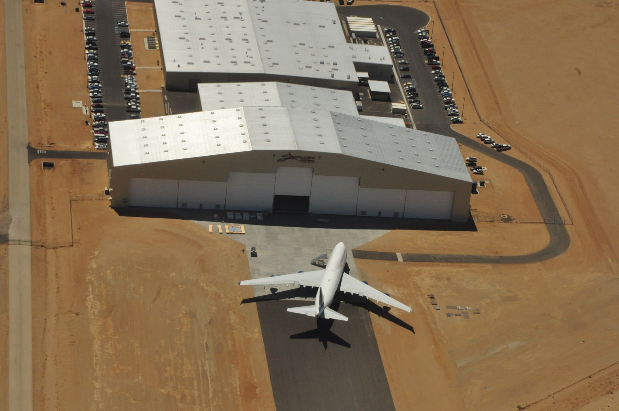
After a great breakfast at the Voyager restaurant, we departed Mojave around 11 AM. We fly just at the edge of Edwards AFB airspace and we could see the famous dry lake (used by NASA space shuttle and Voyager’s around the world non stop flight). Some of the most prolific aircraft were developed in this area like B2 bomber and SR-71. There’s always interesting things happening in this area, I heard a radio call from unmanned aircraft operating in the area. That was my first!
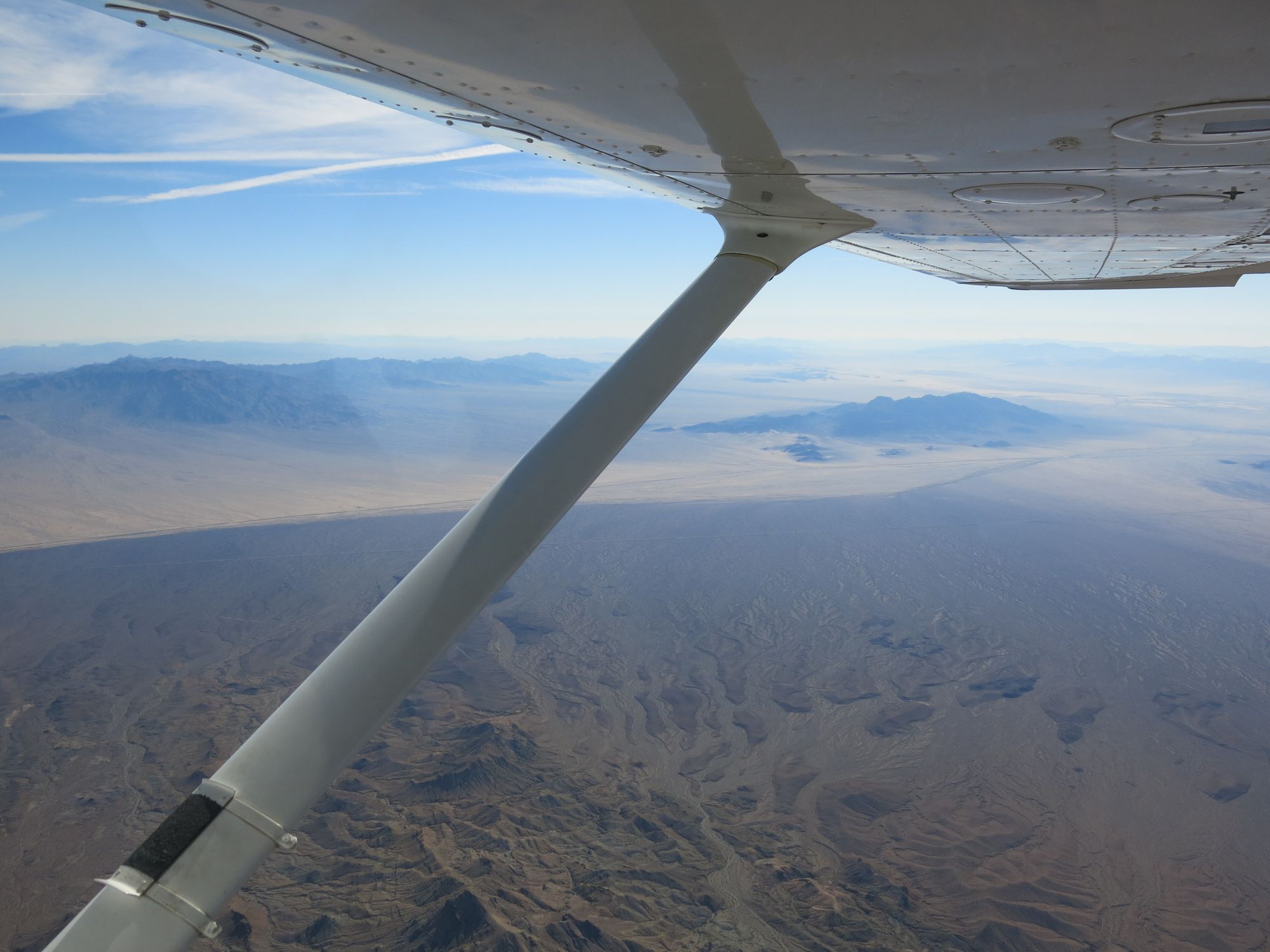
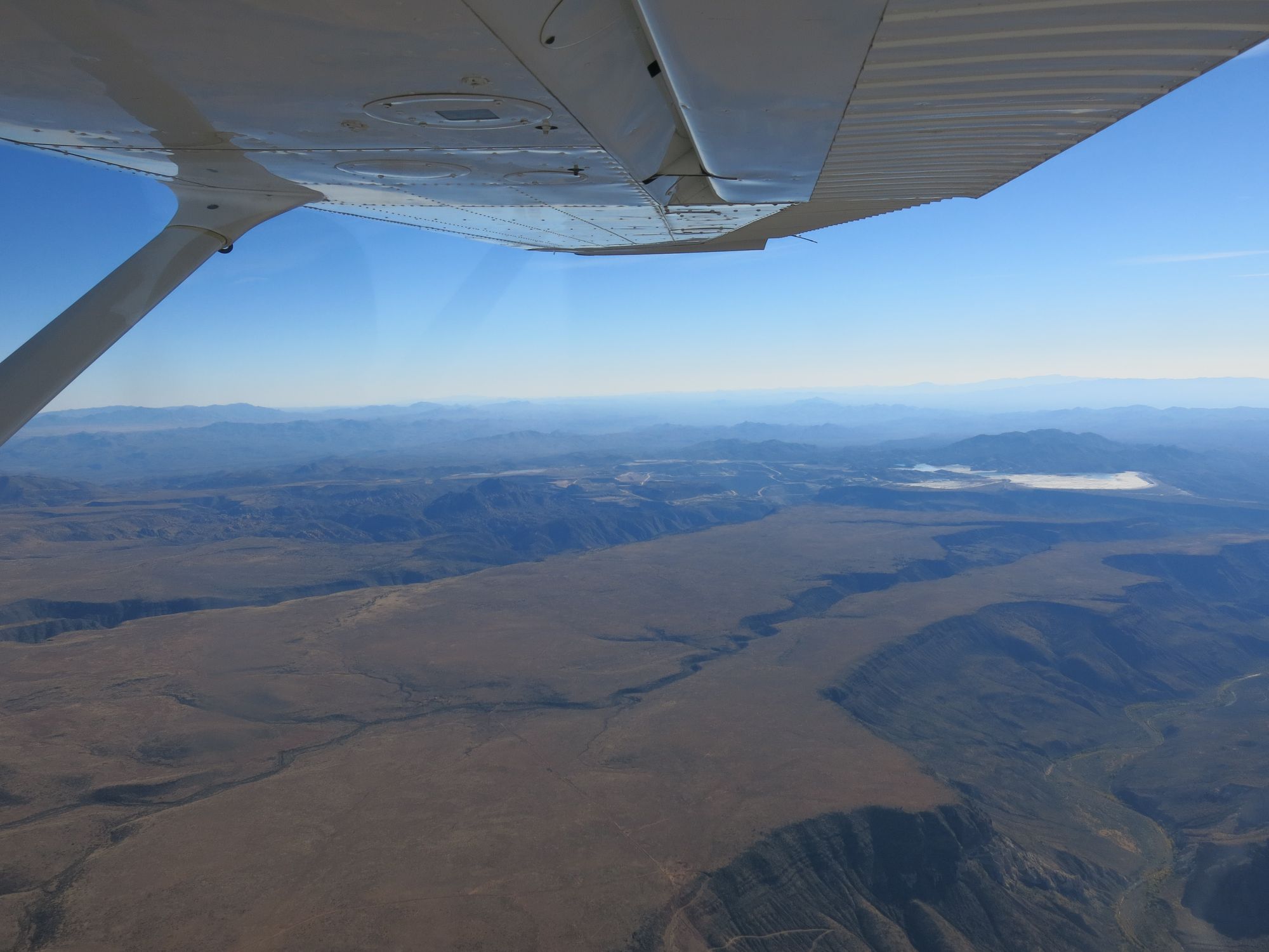
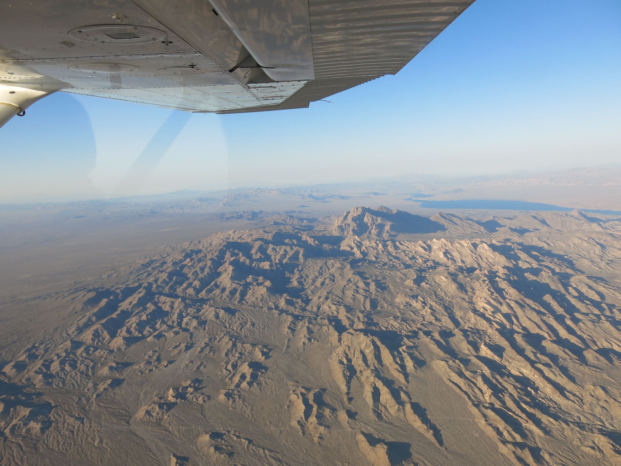
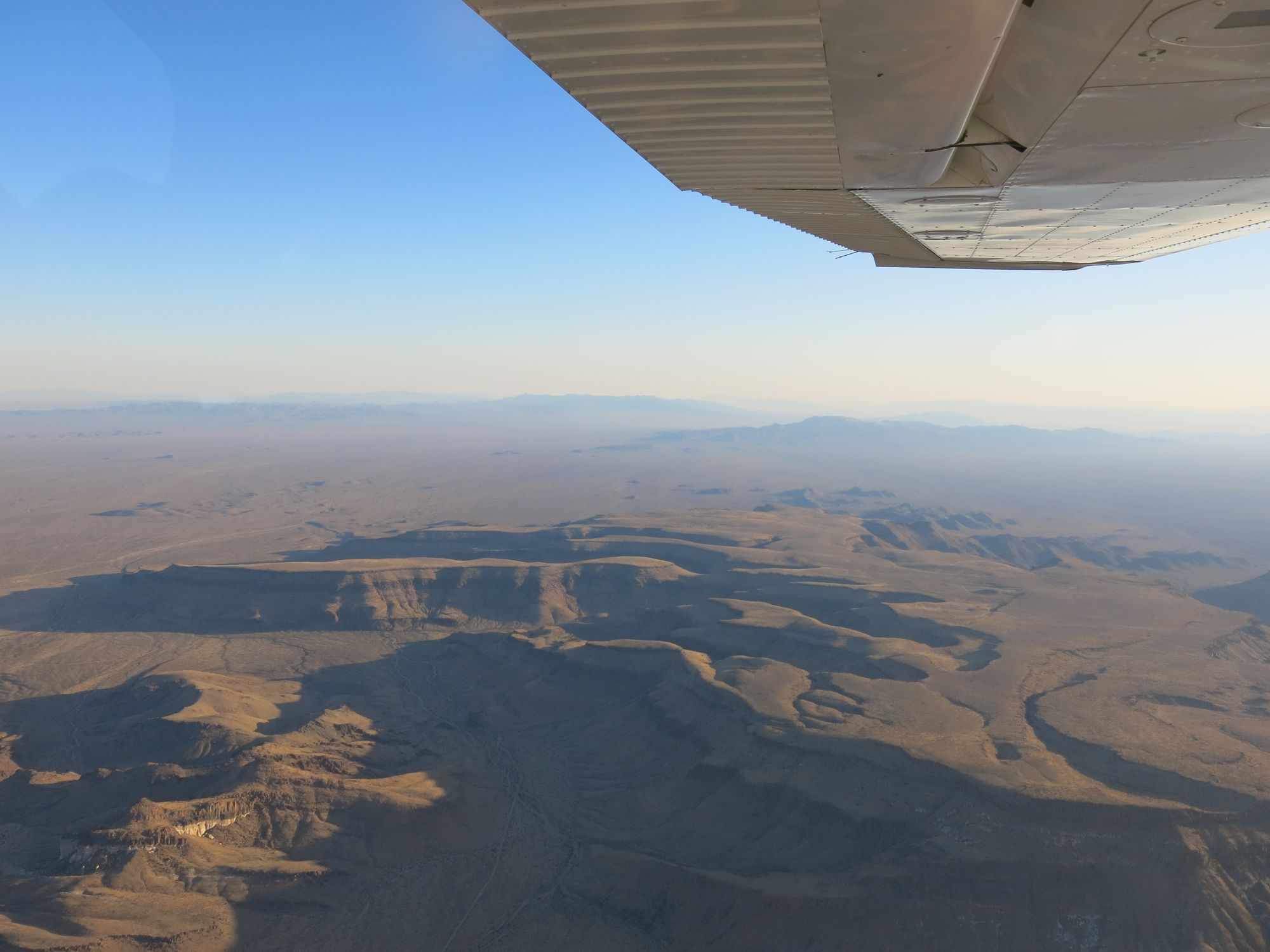
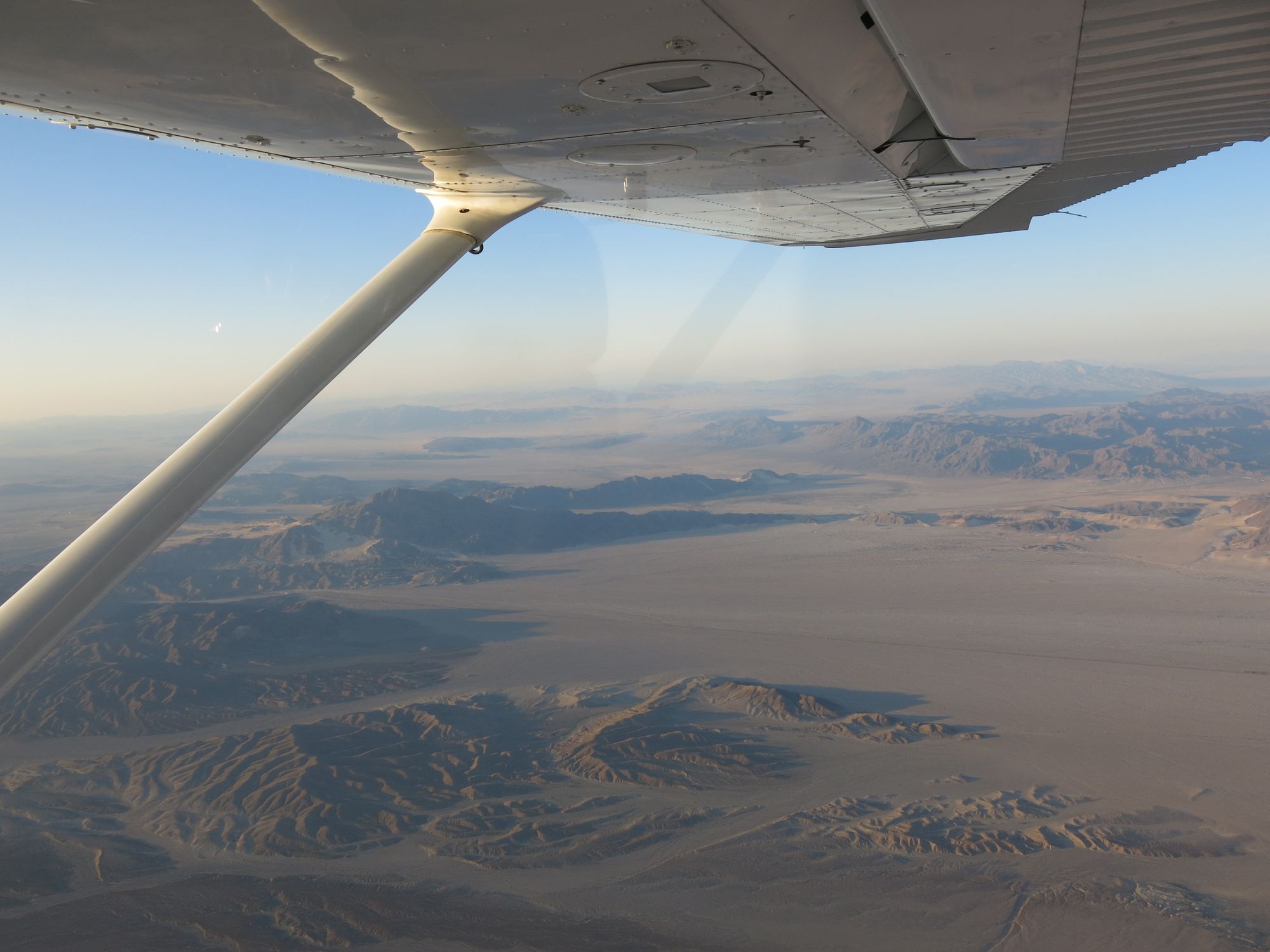
This was going to be roughly 2 hour flight leg. Soon after flying over Barstow, we were truly in wild west. No signs of any settlement miles across, just a thin and long highway and railroad tracks, which we were advised to follow to stay out of restricted airspace (R-2501N). We had about 18 knots of tailwinds which meant we would arrive to next destination bit earlier. I had leaned the mixture for max RPM and the engine was consuming roughly 8 gallons per hour, pretty close to the fuel consumption advised in the aircraft manual. A lot of flying is like herding sheeps, and I learned this very early on in my flight training. I remember Dick referring to this analogy while I was struggling to hold altitude and airspeed, and I bursted into laughter. But it made sense. I must keep all these gauges in the plane showing expected readings. Any single gauge showing unexpected readings should raise an alert in my mind and then I ought to make corrections to bring it back to normal. The key is subconsciously scan these gauges without making an extra effort to think about what gauge to look and then move the head. My eyes now routinely scan the gauges feeding me the data while I fly the plane. This must be learned and practiced.
We had Lake Havasu airport in sight, winds were calm and I asked on radio if a particular runway was favoured by pilots in vicinity. We were second to land after a private lear jet.
Lake Havasu to Sedona, 9,500 feet, refueled 11.4 gallons, night stay.
This was the beginning of flying into the higher elevations. I took off from Lake Havasu and continued climb all the way to 9,500 ft at 70 knots. The airplane was set for best climb performance I could hope for. Along the way, we flew close to Prescott. I went did my undergraduate at Embry-Riddle, an aviation focused university in Daytona Beach and the other campus is located in Prescott. It was right under on my right wing and I could see the airport and I thought to myself what a great place to learn flying. These kids must often fly to Sedona and Grand Canyon.
Flying at higher elevations requires some extra considerations. Due to lesser air density, aircraft performance is greatly reduced. For instance, minimum runway length required at Grand Canyon airport (7,000 feet density altitude) is: 1985 ft, while for Palo Alto (99 feet elevation) its: 1055 ft. Nearly twice. Similarly, climb rate and landing distances are affected. I had to be prepared for these conditions and I was soon going to enter into high terrain.
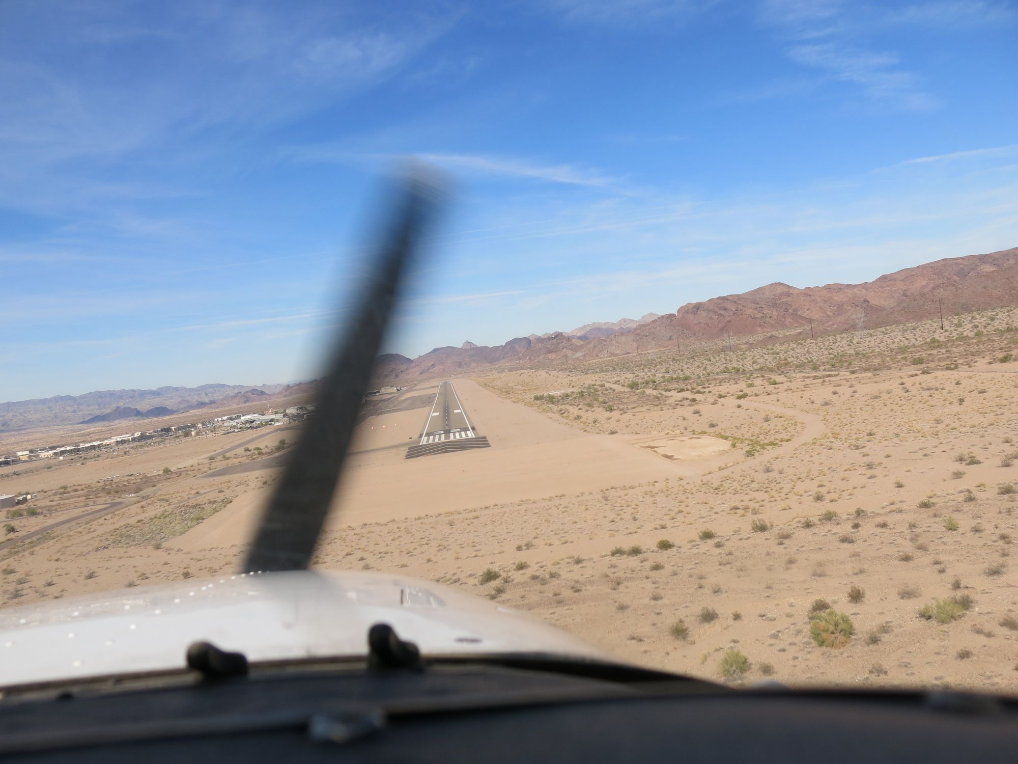
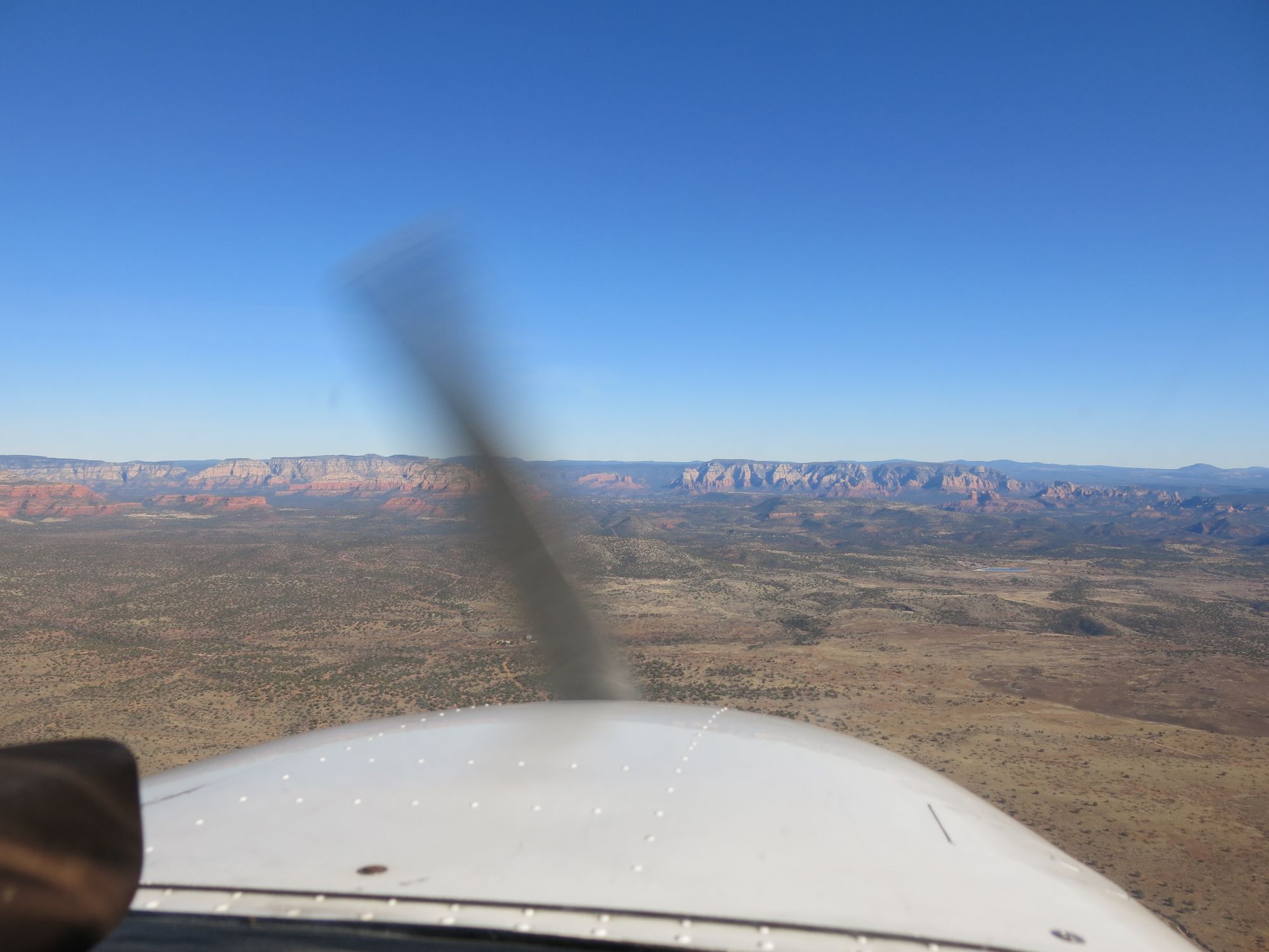
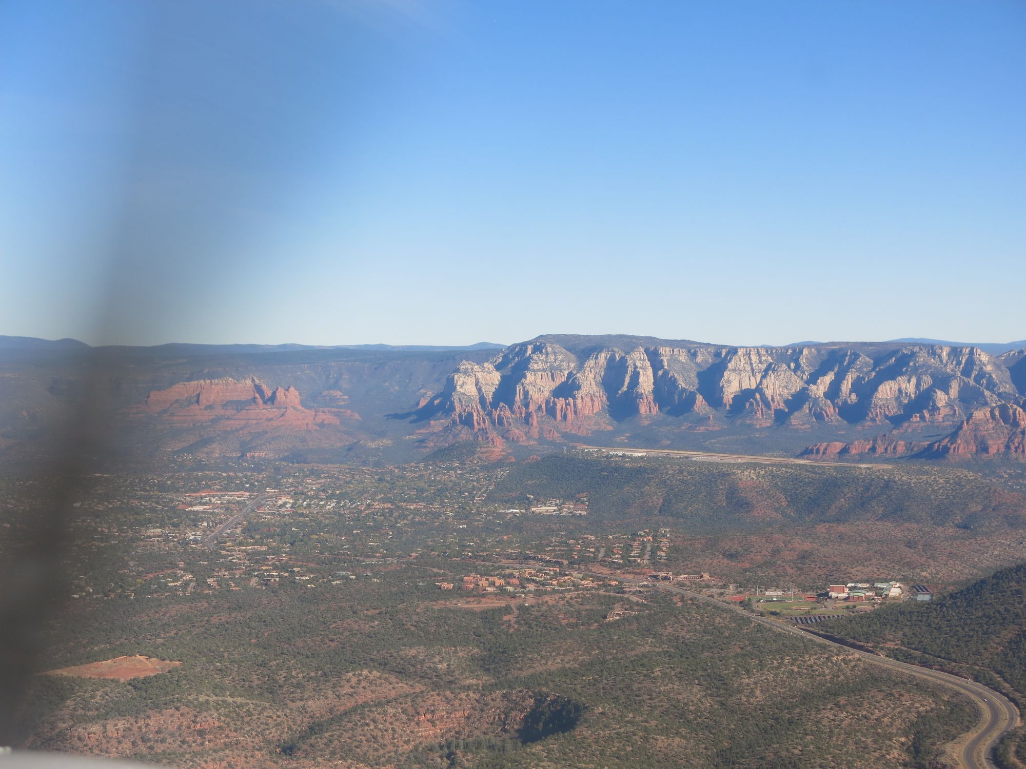
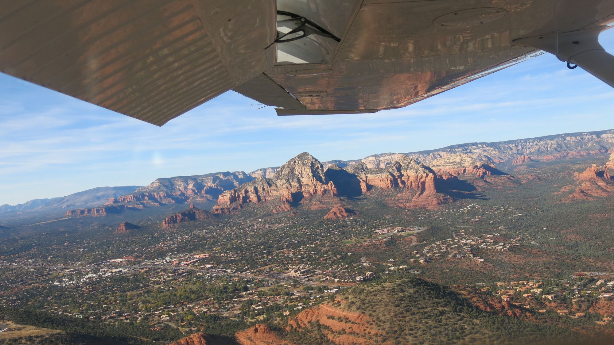
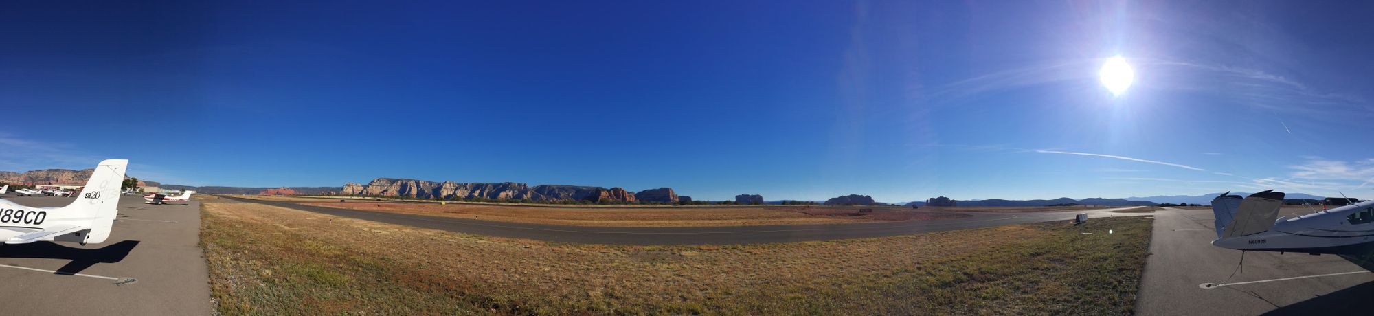
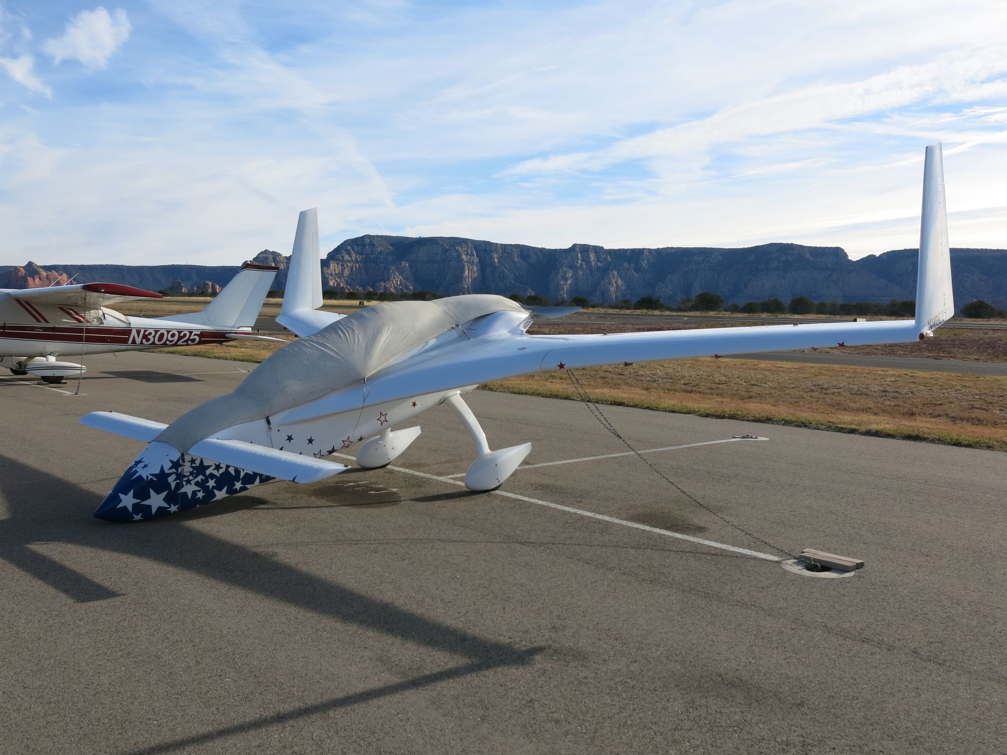
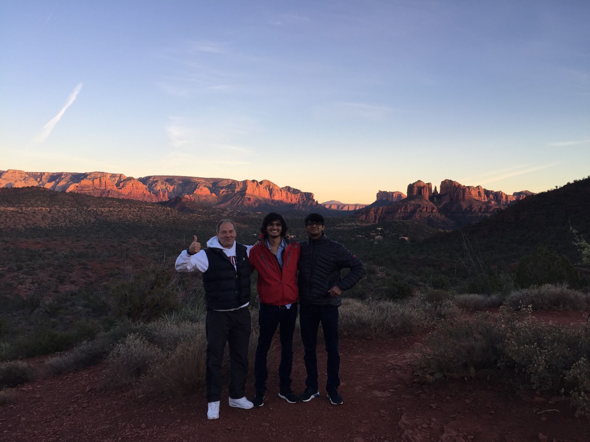
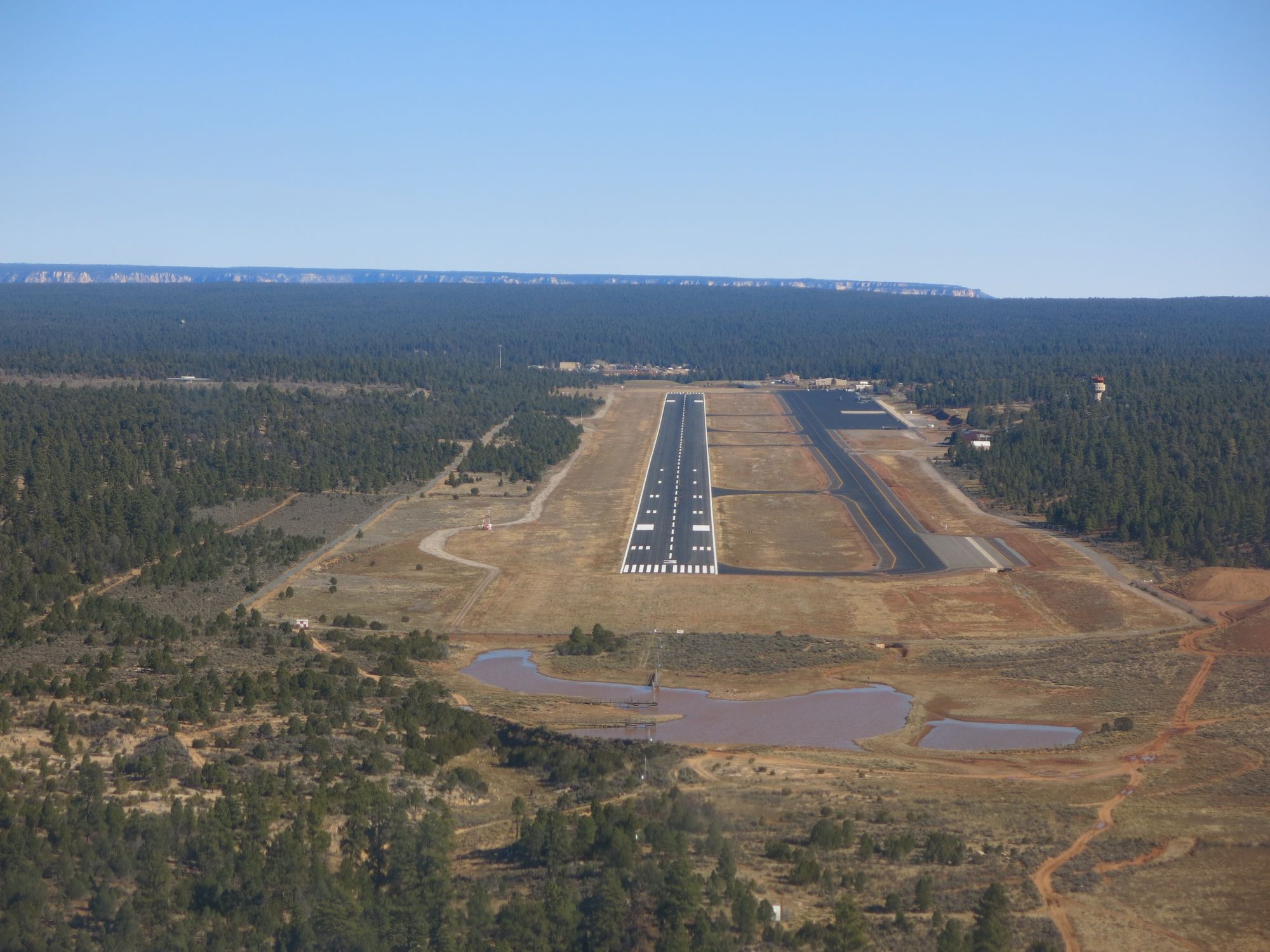
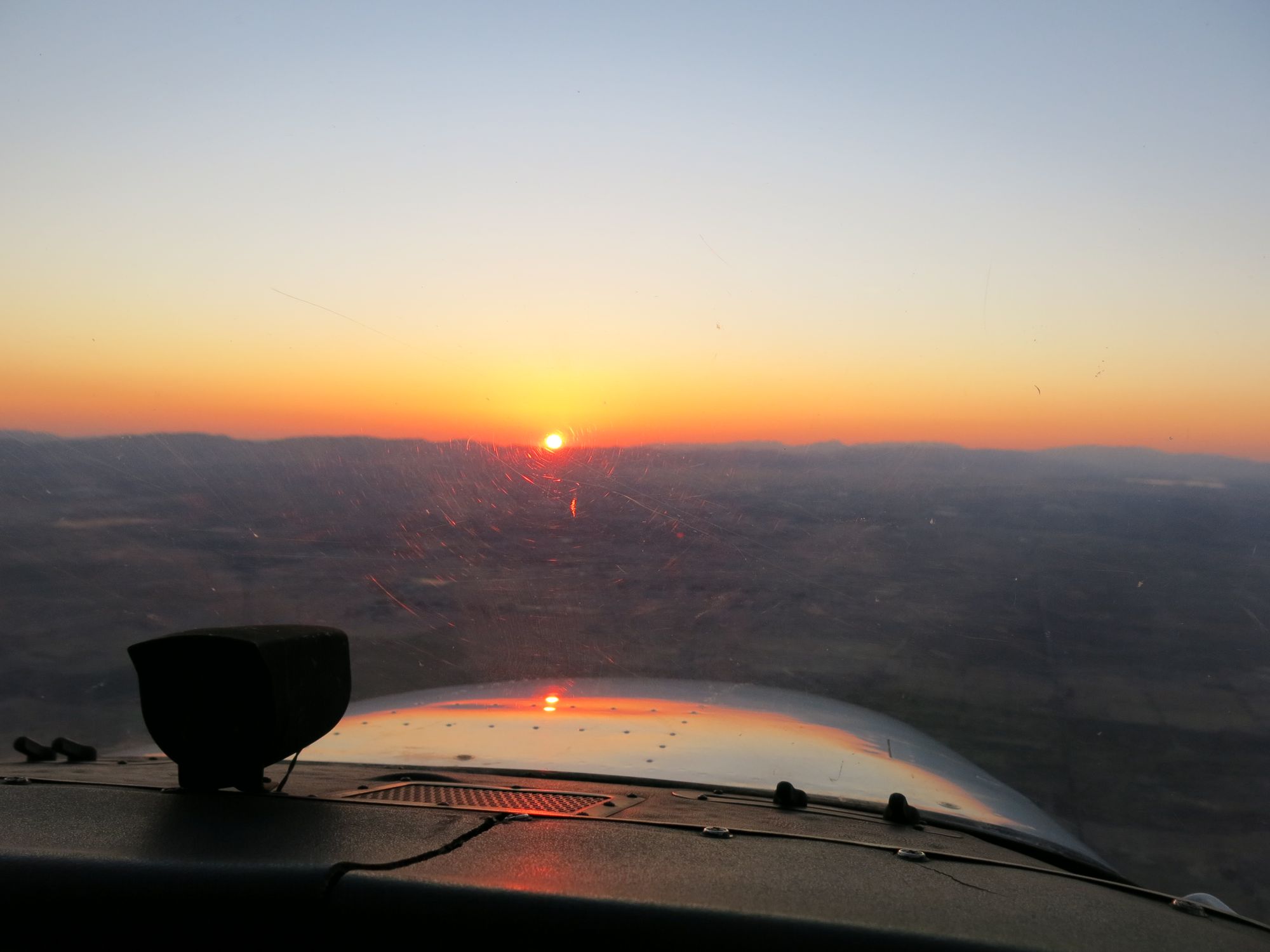
It was surreal to see the first sight of Sedona airport. It's like no other airport I have been to (even commercially). So much excitement and joy and yet I had to focus on flying and making sure we land there safely. Due to higher elevation and the nature of the airport’s approach, I decided to bring down the flaps 30 earlier than usual and kept the engine running around 1500 RPM. Last thing I would want is the engine to quit just short of the hill. We landed and just about when I was to exit the runway, the engine quit. I didn’t knew exactly why right away but later realized that the mixture was too lean for engine to idle at such a higher density altitude. I wasn’t going to miss such an oversight again.
We decided to spend the night in a lodge just next to the airport over the hill. We took uber to the town for dinner and spend some time at local sight seeing spots. The sky in the night from the airport was incredibly revealing. Rahul was in awe seeing the milky way and thousands of stars, something we completely forget about living in the urban areas.
Grand canyon airport was predicted to have winds gusting up to 20 knots and the cold front was approaching in the next 36 hours. Winds usually rise up before the cold front arrives with heaving clouds and rain. I have flown about 6 hours to where I am now and about 40 minutes away from the Grand Canyon. Weather isn’t predicted to be perfect, the airport is at even higher elevation and I am confronting my desire with discouraging data. I had made up my mind to only go to Grand Canyon if the weather was great and that I could confirm with the airport.
Sedona to Grand Canyon, 8,500 feet, did not refuel
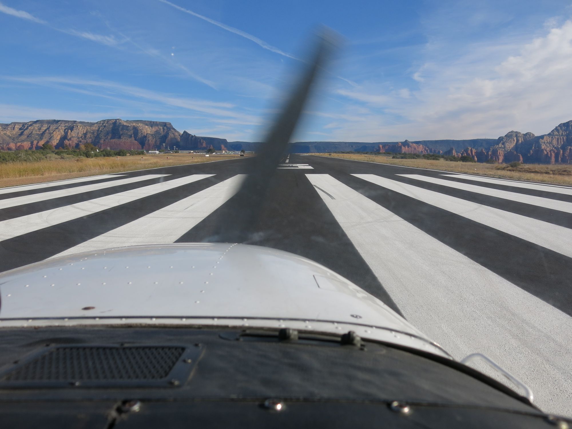
At Sedona airport, winds were gusting from 15-20 knots, and it was predicted that winds were going to be even more later in the night as the cold front approached east wards. We waited at the airport for about 1.5 hours hoping for winds to calm down. I decided to take off when the winds were about 10 knots. With full tanks, at this higher elevation, the aircraft was going to take a lot longer runway to takeoff. Also I must be careful about setting the fuel to air mixture ratio. With engine at max RPM, I played with mixture and tuned it to provide max thrust. It's quite cool to practically see engine RPM going down with mixture full rich - quite opposite to one would expect at Palo Alto airport. I let the engine run for 5 minutes or so at 2500 RPM to let everything in the engine warm up. I also decided to follow a short field takeoff landing maneuver, this includes starting takeoff from the very tip of the runway, 10 degree flaps, full brakes and max thrust. Brakes are released after the engine has accelerated to max RPM. This would save me couple 100s of feet on runway in case of any emergency.
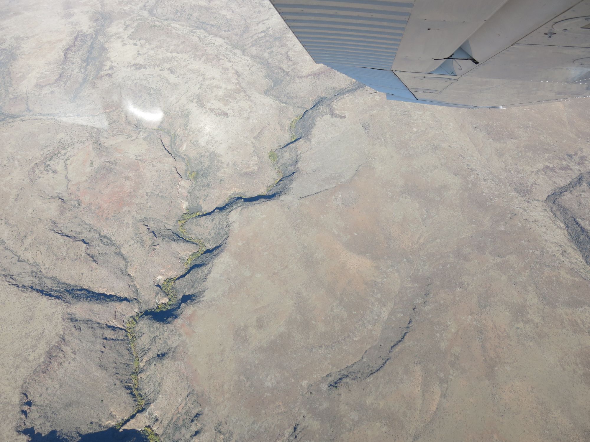
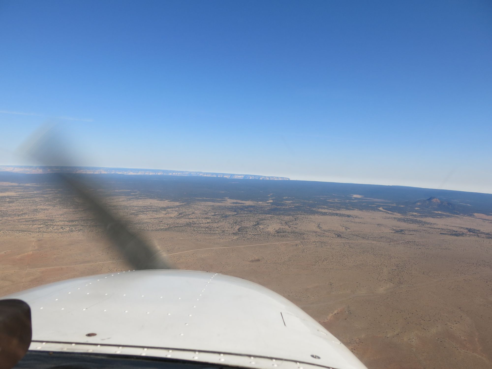
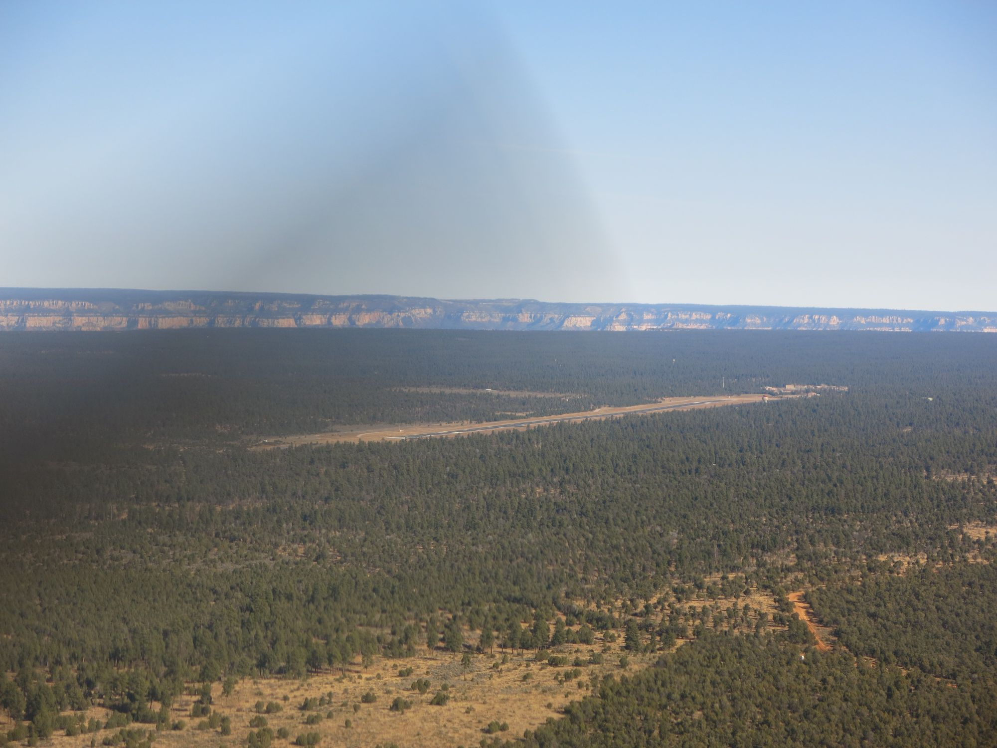
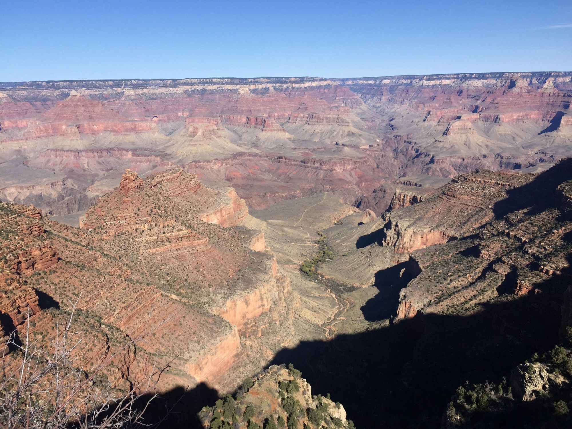
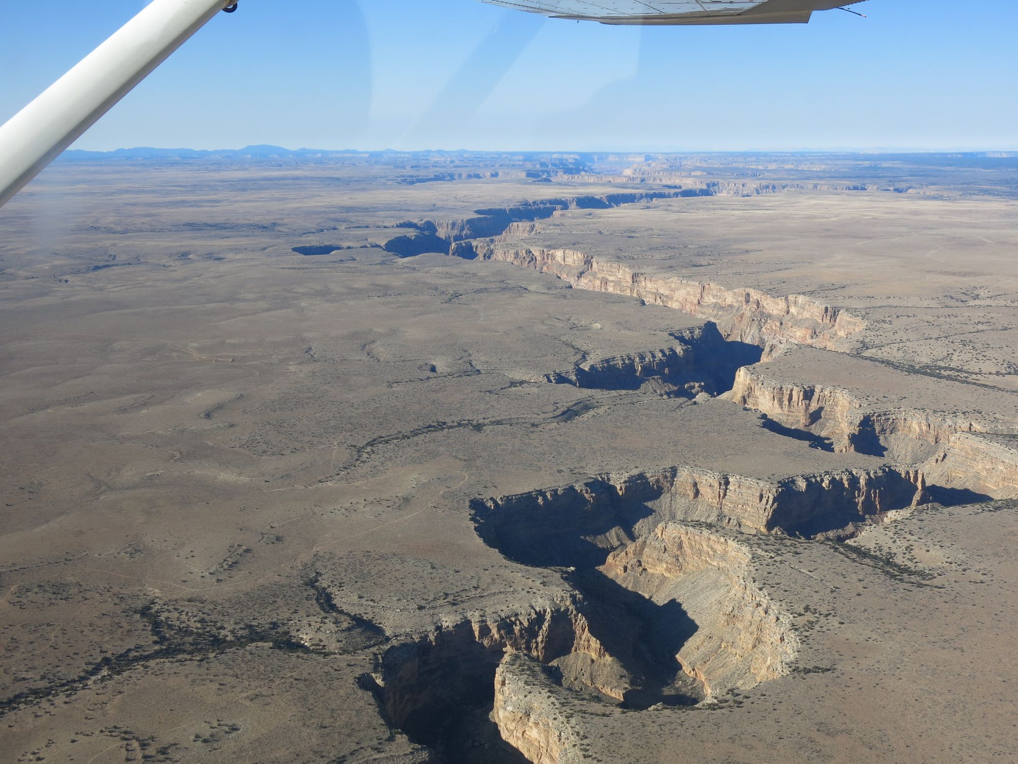
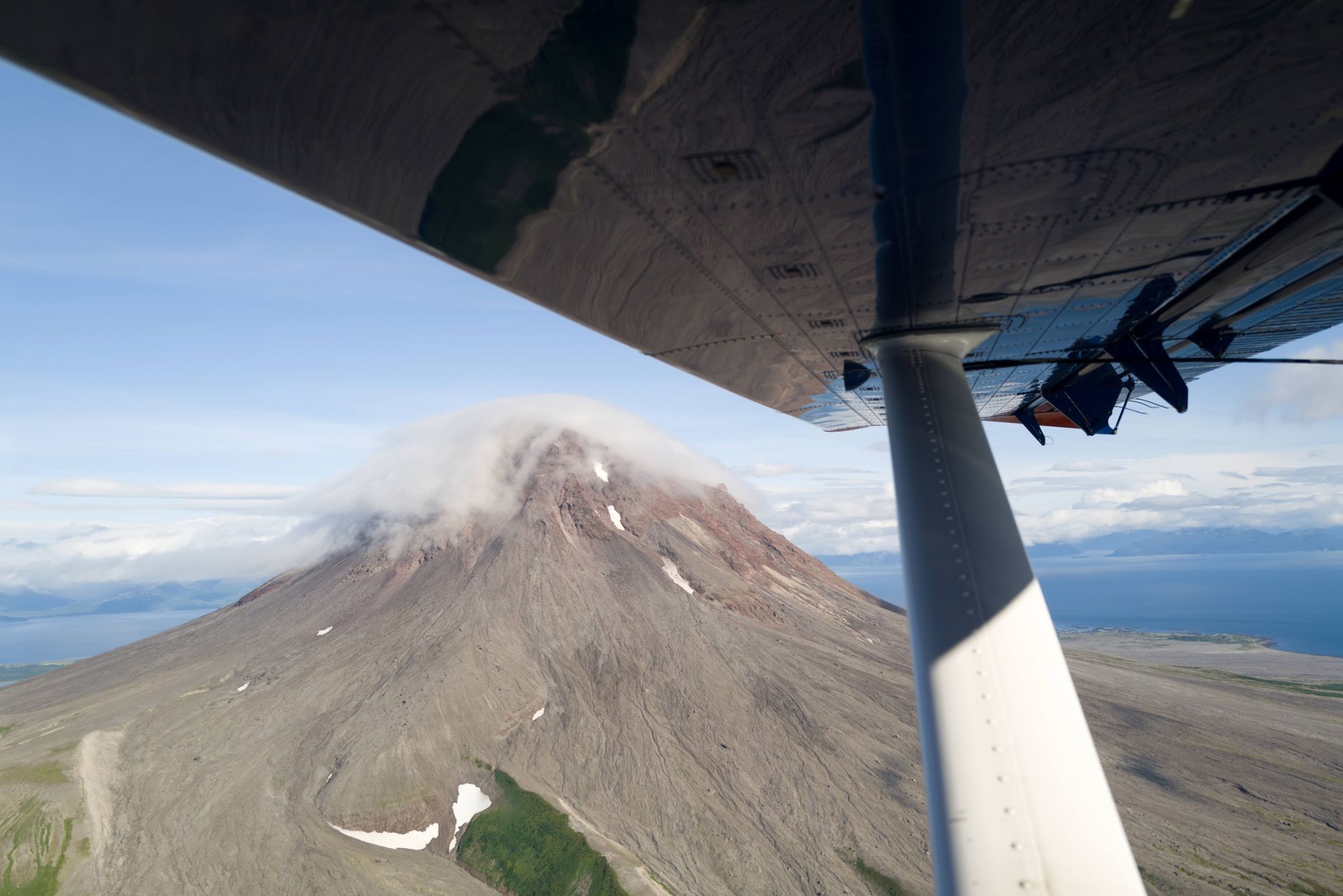
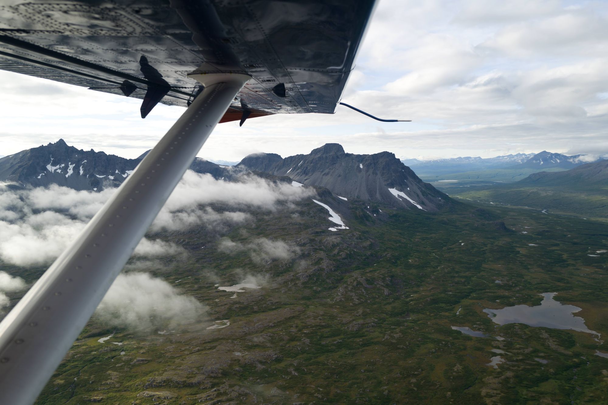
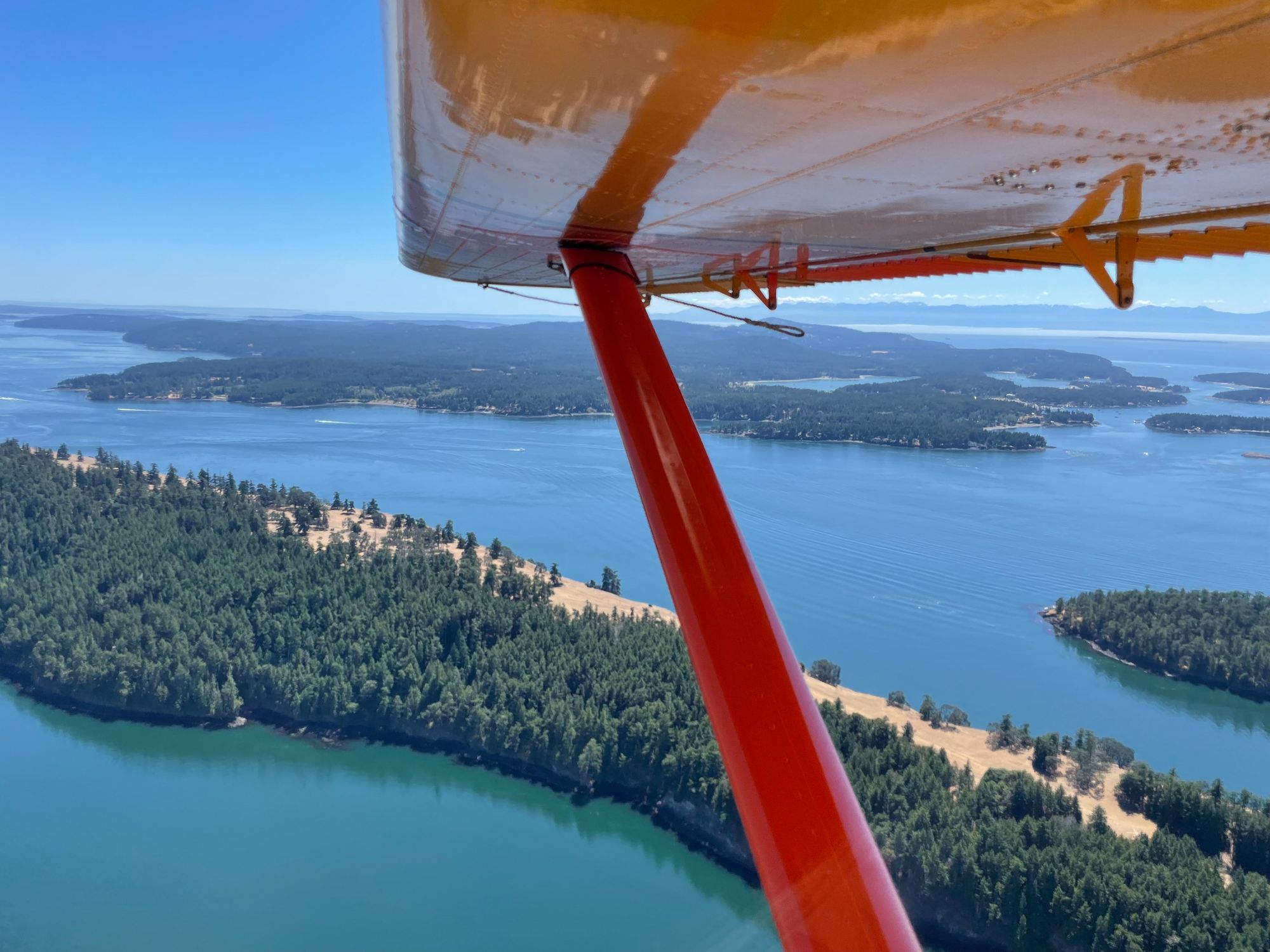
On our way out to west, I was able to tune to Grand Canyon airport to hear the current weather. The surface winds were better than I expected and I turned the aircraft right towards the airport. The land got flatter as we approached Grand Canyon and then we could see the edge and then the other side. Between those two edges is a cut as deep as 1.8 km!
Approach to grand canyon was pretty straight forward. After securing the plan we took a cab to the edge of the canyon -- about 4-5 miles away.
Grand Canyon to Kingman
After spending around 3 hours at Grand Canyon and a lunch, we took off from the Grand Canyon around 2:30 PM. I did not refueled at this airport, wanting to keep the aircraft lighter for better performance. I also moved the heavier bags from luggage to rear seat hoping to move the center of gravity bit forward for better handling, not sure how much this helped, but I tried to do everything I could think of that would make the aircraft perform better. I followed same takeoff process and maneuver as I conducted at Sedona airport. Soon we were airborne and headed west again.
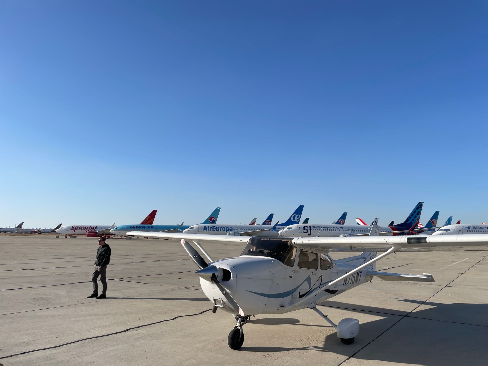
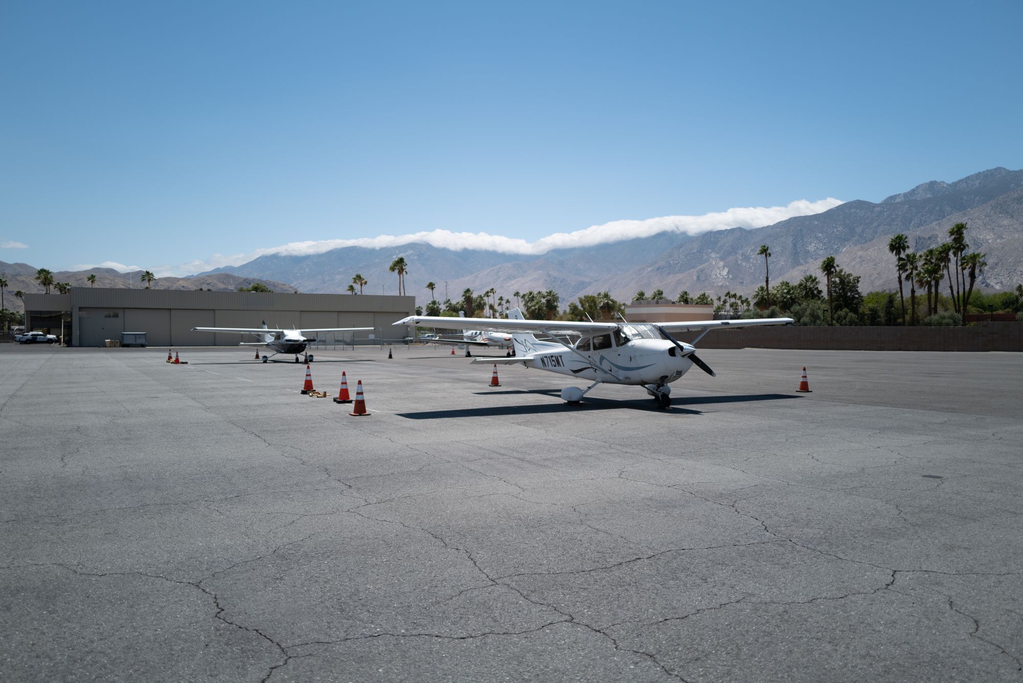
Kingman airport was quite interesting! There are so many airplanes and yet we didn’t see anyone. It looked like we were the only people surrounded by hundreds of airplanes on this airport. Winds seemed to catch up and soon after refueling, we took off towards west.
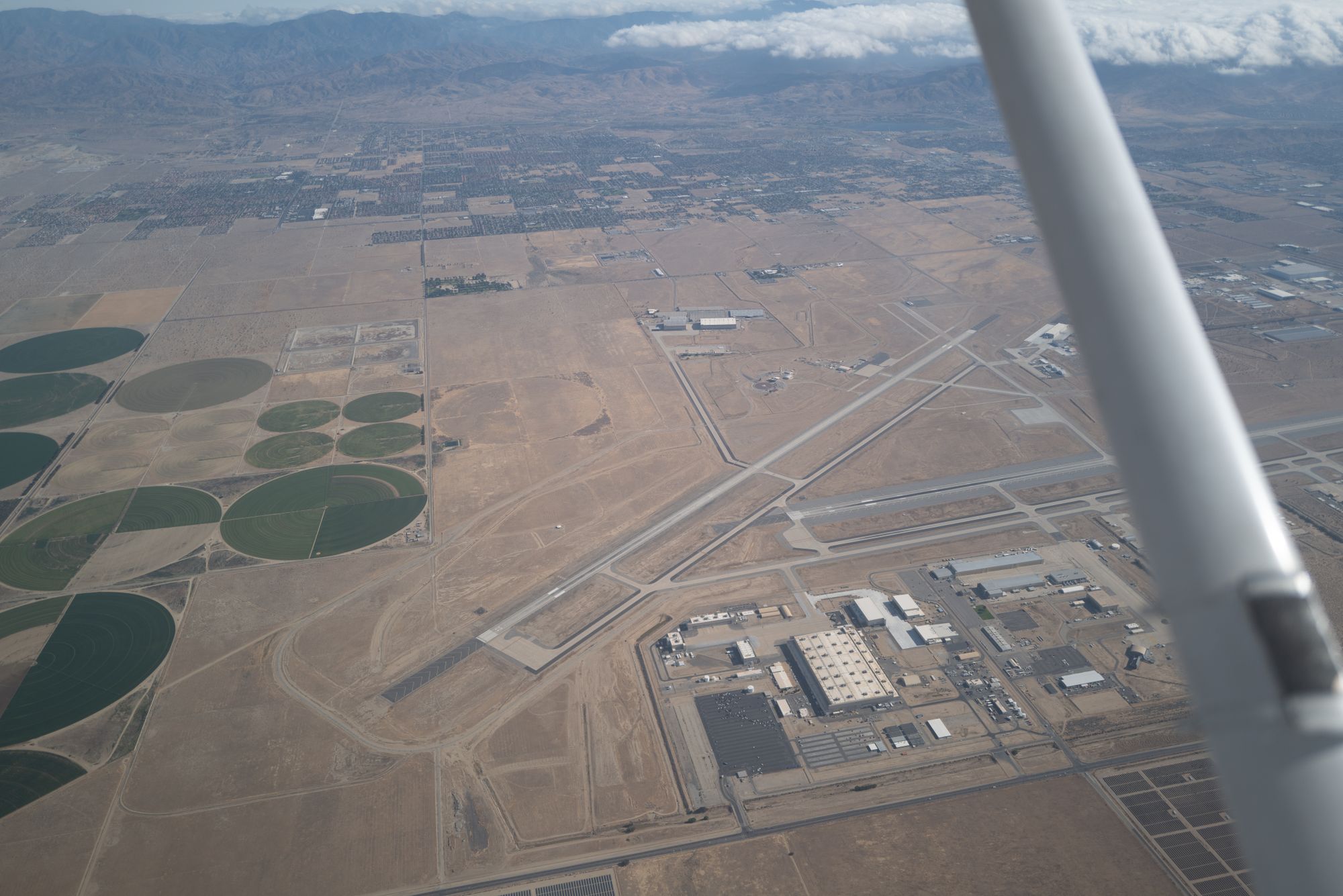
Kingman to Lancaster, refueled 18.8 gallons, night stay.
This was very chill flight. Now I am approaching more familiar territory. I realized that we could not have made this trip in the summer. The density altitude would be even more higher than it was now due to high temperature and this Cessna 172S would not be an adequate machine with 2 passengers and luggage. Glad we did this in the cold weather.
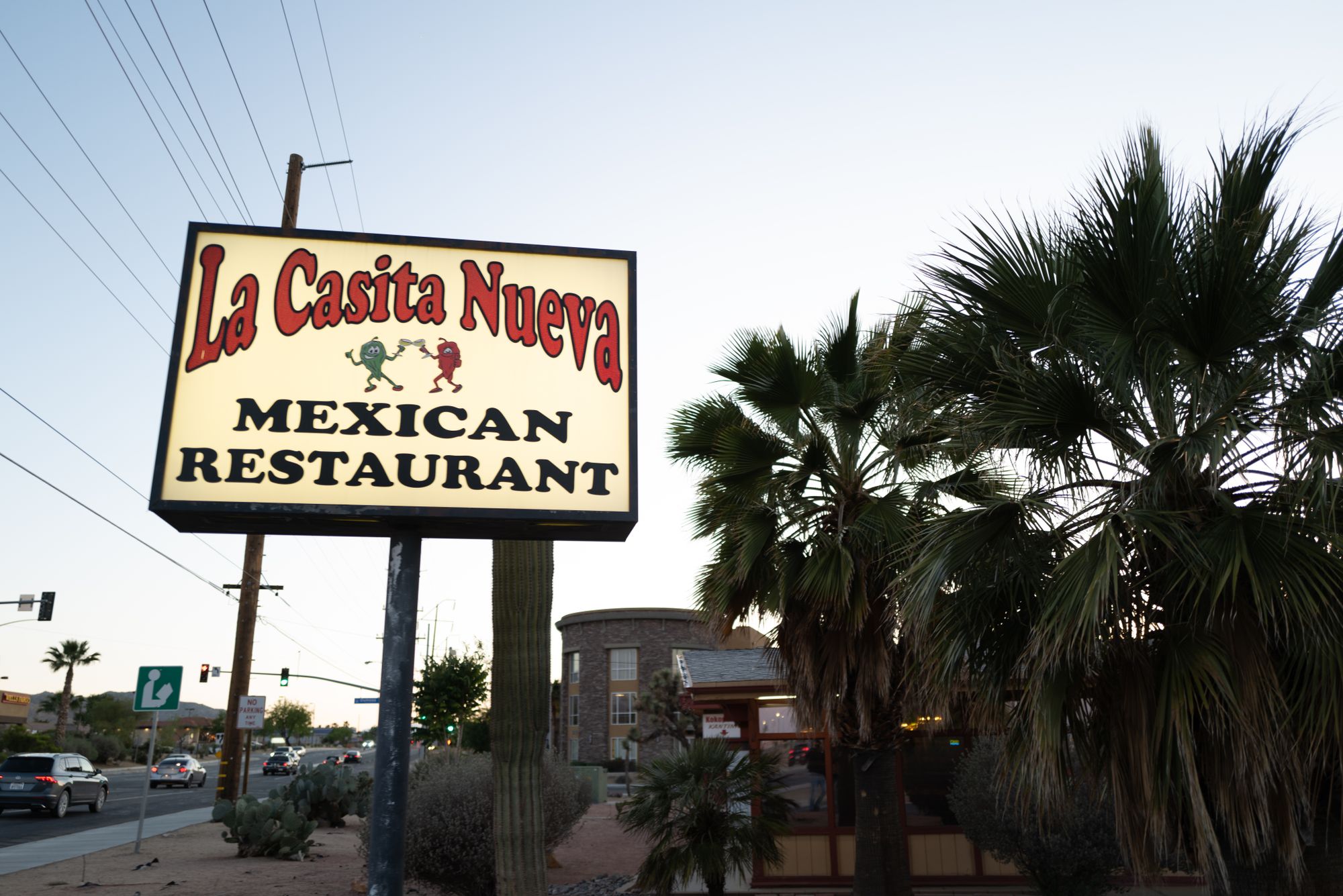
Its great to see many airports now on the ground and I could chose any to land and spend the night. I was tempted to fly to Palmdale but chose Lancaster, it small and enroute home. Airport and FBO was closed by the time we secured the aircraft and no uber either. There was a card in the lounge which indicated to belong to a guy who offered local taxi service. I called him and he picked us up and drove to hotel. But first we drove to Denny’s and had a very satisfying meal.
Lancaster to Palo Alto
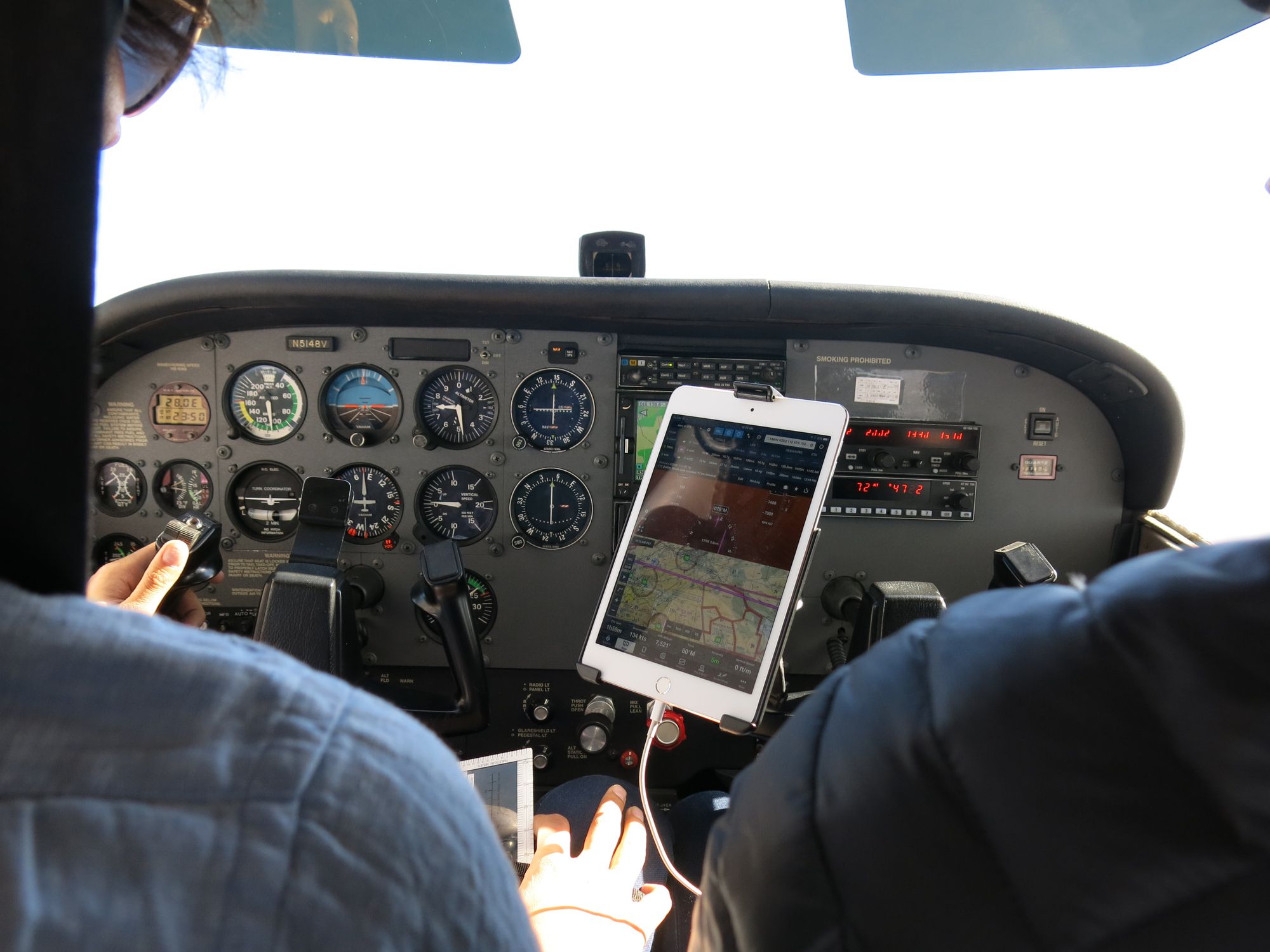
This flight was special in a way that I finally decided to play with the onboard autopilot. At cruise, I let Tomi on the right to hold the yoke while I glanced over the autopilot manual to understand basic function to hold altitude. Soon, I figured it out and flew this leg entirely on autopilot that held our course straight to Palo Alto. I used the autopilot to descend into San Jose airspace and set ourselves for approach to the Palo Alto airport. What a difference it made! This time I had so much more time to look the gauges, at play with different settings, look outside at the view and contemplate. I realized I loved being in the plane more than being on the ground. It's a lot more fun to be inside the cockpit and travelling to somewhere than to arrive.
(Thanks to Nathana, Brian and Soshana for reading the draft of this)


